 |
| Professional Paper 1643: FIGURE 32 |
Figure 32
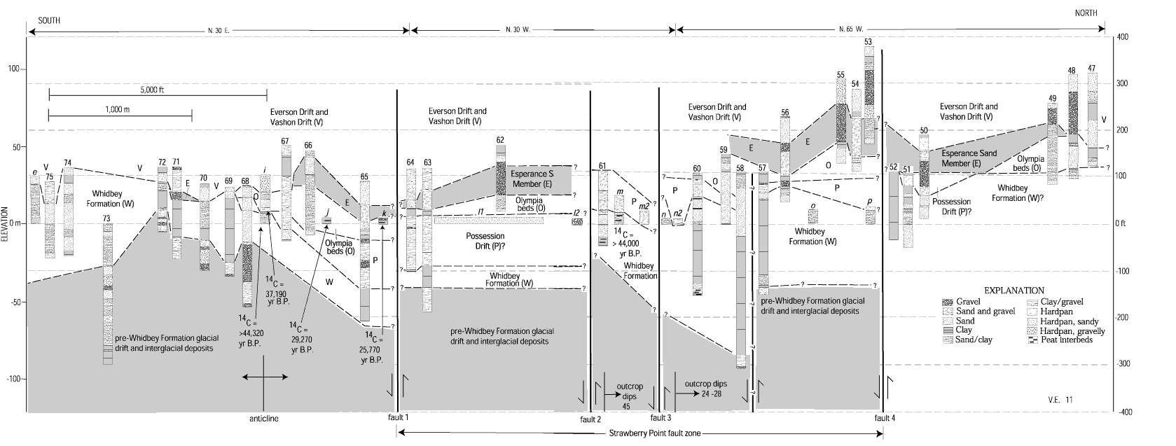
Interpretive stratigraphic correlation diagram parallel to coast of Strawberry Point crossing Strawberry Point fault zone, using outcrop data (figs. 27, 31; lettered sections) and lithologic logs from water wells (table 1, figure 28; numbered sections), northern Whidbey Island. Faults queried where uncertain; arrows show sense of relative fault offset. Faults queried where uncertain; arrows show sense of relative fault offset.
Use BACK button to return
Contact: Susan Rhea
This page is brought to you by the Earthquake Hazards Program
