 |
|
|
||||
| Professional Paper 1643: FIGURE 33 |
| About USGS / Science Topics / Maps, Products & Publications / Education / FAQ |
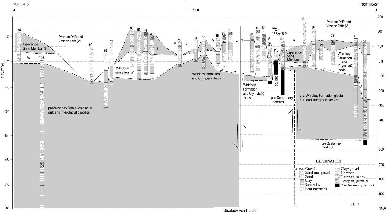
Interpretive stratigraphic correlation diagram crossing Utsalady Point fault zone, northwestern Whidbey Island (figs. 27, 28). Correlation diagram is based on a few outcrops (figure 27; lettered sections) and lithologic logs from water wells (table 1, figure 28; numbered sections).
Use BACK button to return
| AccessibilityFOIAPrivacyPolicies and Notices | |
| |
|