 |
| Professional Paper 1643: FIGURE 35 |
Figure 35
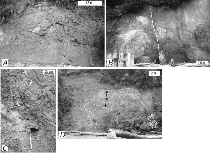
Deformation and facies in upper Pleistocene deposits in Utsalady Point fault zone at Utsalady Point, Camano Island (r in figure 27; figure 34). A, Folded (24° dip) and fractured ≈21-ka laminated sandy silt facies. Staff is 1.5 m long. B, Fault (dashed white line) cutting silty mud, sand, and gravel (line drawing in figure 34). C, Shear fabric along fault shown in B. Bands on shovel handle are 10 cm wide. D. Large irregular sandy silt intrusion (SI, dashed white line shows boundaries) and "bed" of sand, silt, and gravel mixed by extensive liquefaction and soft-sediment deformation (LB).
Use BACK button to return
Contact: Susan Rhea
This page is brought to you by the Earthquake Hazards Program
