 |
|
|
||||
| Professional Paper 1643: FIGURE 36 |
| About USGS / Science Topics / Maps, Products & Publications / Education / FAQ |
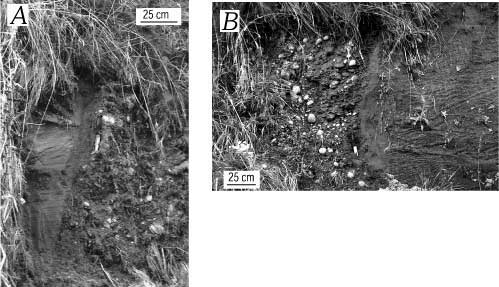
Faults (A, B)exposed in a vegetated roadcut 900 m southeast of the fault exposed at Utsalady Point (s in figure 27), cutting inferred Vashon glaciofluvial advance deposits. The faults, which juxtapose well-stratified sand and massive gravel, are 15 m apart and occur within the Utsalady Point fault zone.
Use BACK button to return
| AccessibilityFOIAPrivacyPolicies and Notices | |
| |
|