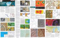
Geographic Information Systems
Links
- More information: Publisher Index Page (via DOI)
- Plates:
- Download citation as: RIS | Dublin Core
Abstract
Geographic information system (GIS) technology can be used for scientific investigations, resource management, and development planning. For example, a GIS might allow emergency planners to easily calculate emergency response times in the event of a natural disaster, or a GIS might be used to find wetlands that need protection from pollution.
Suggested Citation
U.S. Geological Survey, 2002, Geographic Information Systems: General Information Product, 2 Plates: 34.09 x 21.60 inches, https://doi.org/10.3133/70201216.
| Publication type | Report |
|---|---|
| Publication Subtype | USGS Unnumbered Series |
| Title | Geographic Information Systems |
| Series title | General Information Product |
| DOI | 10.3133/70201216 |
| Year Published | 2002 |
| Language | English |
| Publisher | U.S. Geological Survey |
| Description | 2 Plates: 34.09 x 21.60 inches |


