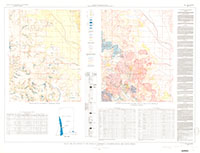
Geology and coal deposits of the Jasonville quadrangle, Clay, Greene and Sullivan Counties, Indiana
Links
- Plate: Plate 1 (pdf)
- NGMDB Index Page: National Geologic Map Database Index Page
- Download citation as: RIS | Dublin Core
Abstract
The accompanying report on the Jasonville quadrangle is the first of a series of quadrangle surveys carried out by the Division of Geology, Indiana Department of Conservation, with the cooperation of the U.S. Geological Survey, as part of a program of study and appraisal of Indiana coal resources. The field work was done by Preston McGrain and the writer from June 15 to July 31, 1947, and completed by the writer in December 1947.
Suggested Citation
Wier, C.E., 1950, Geology and coal deposits of the Jasonville quadrangle, Clay, Greene and Sullivan Counties, Indiana: U.S. Geological Survey Coal Map 1, 1 Plate: 49.75 × 37.99 inches, https://doi.org/10.3133/coal1.
Study Area
| Publication type | Report |
|---|---|
| Publication Subtype | USGS Numbered Series |
| Title | Geology and coal deposits of the Jasonville quadrangle, Clay, Greene and Sullivan Counties, Indiana |
| Series title | Coal Map |
| Series number | 1 |
| ISBN | 0607758449 |
| DOI | 10.3133/coal1 |
| Year Published | 1950 |
| Language | English |
| Publisher | U.S. Geological Survey |
| Description | 1 Plate: 49.75 × 37.99 inches |
| Country | United States |
| State | Indiana |
| County | Clay County, Greene County, Sullivan County |
| Other Geospatial | Jasonville quadrangle |
| Scale | 62500 |

