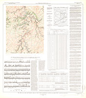
The Fire Clay and Whitesburg coals in the Hyden quadrangle, Leslie, Clay, and Perry Counties, Kentucky
Links
- Plate: Plate 1 (pdf)
- Download citation as: RIS | Dublin Core
Abstract
This preliminary report on the coal in the Hyden quadrangle, Kentucky, presents data on two of the principal commercial coals. The Fire Clay is the most valuable commercial coal in the quadrangle, and locally the Whitesburg bed is of minable thickness. Special emphasis has been placed on determining the thickness, extent, composition, and structure of these beds, and on obtaining an accurate estimate of the coal reserves.
Suggested Citation
Johnston, J.E., Heck, W.A., 1950, The Fire Clay and Whitesburg coals in the Hyden quadrangle, Leslie, Clay, and Perry Counties, Kentucky: U.S. Geological Survey Coal Map 5, 31.88 x 36.15 inches, https://doi.org/10.3133/coal5.
Study Area
| Publication type | Report |
|---|---|
| Publication Subtype | USGS Numbered Series |
| Title | The Fire Clay and Whitesburg coals in the Hyden quadrangle, Leslie, Clay, and Perry Counties, Kentucky |
| Series title | Coal Map |
| Series number | 5 |
| DOI | 10.3133/coal5 |
| Year Published | 1950 |
| Language | English |
| Publisher | U.S. Geological Survey |
| Description | 31.88 x 36.15 inches |
| Country | United States |
| State | Kentucky |
| County | Clay County, Leslie County, Perry County |
| Other Geospatial | Hyden Quadrangle |
| Scale | 62500 |

