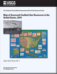
Map of assessed coalbed-gas resources in the United States, 2014
Links
- More information: USGS Index Page
- Document: Report (10.2 MB pdf)
- Plate: Map (5.3 MB pdf)
- Companion Files:
- Download citation as: RIS | Dublin Core
Abstract
This report presents a digital map of coalbed-gas resource assessments in the United States as part of the U.S. Geological Survey’s (USGS) National Assessment of Oil and Gas Project. Using a geology-based assessment methodology, the USGS quantitatively estimated potential volumes of undiscovered, technically recoverable natural gas resources within coalbed-gas assessment units (AUs). This is the third digital map product in a series of USGS unconventional oil and gas resource maps. The map plate included in this report can be printed in hardcopy form or downloaded in a Geographic Information System (GIS) data package, including an ArcGIS ArcMap document (.mxd), geodatabase (.gdb), and published map file (.pmf). In addition, the publication access table contains hyperlinks to current USGS coalbed-gas assessment publications and web pages.
Suggested Citation
U.S. Geological Survey National Assessment of Oil and Gas Resources Team, Biewick, L., 2014, Map of assessed coalbed-gas resources in the United States, 2014: U.S. Geological Survey Data Series 69, Report: iii, 6 p.; Map: 46.00 x 35.00 inches; Table; Downloads Directory, https://doi.org/10.3133/ds69II.
ISSN: 2327-638X (online)
Study Area
| Publication type | Report |
|---|---|
| Publication Subtype | USGS Numbered Series |
| Title | Map of assessed coalbed-gas resources in the United States, 2014 |
| Series title | Data Series |
| Series number | 69 |
| Chapter | II |
| DOI | 10.3133/ds69II |
| Year Published | 2014 |
| Language | English |
| Publisher | U.S. Geological Survey |
| Publisher location | Reston, VA |
| Contributing office(s) | Central Energy Resources Science Center |
| Description | Report: iii, 6 p.; Map: 46.00 x 35.00 inches; Table; Downloads Directory |
| Public Comments | U.S. Geological Survey National Assessment of Oil and Gas Resources Project |
| Time Range Start | 2014-01-01 |
| Time Range End | 2014-12-31 |
| Country | United States |
| Datum | North American Datum of 1983 |
| Projection | Albers Equal Area Conic projection |
| Online Only (Y/N) | Y |
| Additional Online Files (Y/N) | N |


