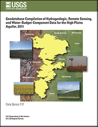
Geodatabase compilation of hydrogeologic, remote sensing, and water-budget-component data for the High Plains aquifer, 2011
Links
- More information: USGS Index Page
- Document: Report
- Download citation as: RIS | Dublin Core
Abstract
The High Plains aquifer underlies almost 112 million acres in the central United States. It is one of the largest aquifers in the Nation in terms of annual groundwater withdrawals and provides drinking water for 2.3 million people. The High Plains aquifer has gained national and international attention as a highly stressed groundwater supply primarily because it has been appreciably depleted in some areas. The U.S. Geological Survey has an active program to monitor the changes in groundwater levels for the High Plains aquifer and has documented substantial water-level changes since predevelopment: the High Plains Groundwater Availability Study is part of a series of regional groundwater availability studies conducted to evaluate the availability and sustainability of major aquifers across the Nation. The goals of the regional groundwater studies are to quantify current groundwater resources in an aquifer system, evaluate how these resources have changed over time, and provide tools to better understand a systems response to future demands and environmental stresses. The purpose of this report is to present selected data developed and synthesized for the High Plains aquifer as part of the High Plains Groundwater Availability Study. The High Plains Groundwater Availability Study includes the development of a water-budget-component analysis for the High Plains completed in 2011 and development of a groundwater-flow model for the northern High Plains aquifer. Both of these tasks require large amounts of data about the High Plains aquifer. Data pertaining to the High Plains aquifer were collected, synthesized, and then organized into digital data containers called geodatabases. There are 8 geodatabases, 1 file geodatabase and 7 personal geodatabases, that have been grouped in three categories: hydrogeologic data, remote sensing data, and water-budget-component data. The hydrogeologic data pertaining to the northern High Plains aquifer is included in three separate geodatabases: (1) base data from a groundwater-flow model; (2) hydrogeology and hydraulic properties data; and (3) groundwater-flow model data to be used as calibration targets. The remote sensing data for this study were developed by the U. S. Geological Survey Earth Resources Observation and Science Center and include historical and predicted land-use/land-cover data and actual evapotranspiration data by using remotely sensed temperature data. The water-budget-component data contains selected raster data from maps in the “Selected Approaches to Estimate Water-Budget Components of the High Plains, 1940 Through 1949 and 2000 Through 2009” report completed in 2011 (http://pubs.usgs.gov/sir/2011/5183/). Federal Geographic Data Committee compliant metadata were created for each spatial and tabular data layer in the geodatabases.
Suggested Citation
Houston, N.A., Gonzales-Bradford, S.L., Flynn, A., Qi, S.L., Peterson, S.M., Stanton, J.S., Ryter, D.W., Sohl, T.L., Senay, G., 2013, Geodatabase compilation of hydrogeologic, remote sensing, and water-budget-component data for the High Plains aquifer, 2011: U.S. Geological Survey Data Series 777, Report: vii, 12 p.; 29 Datasets, https://doi.org/10.3133/ds777.
ISSN: 2327-638X (online)
Study Area
| Publication type | Report |
|---|---|
| Publication Subtype | USGS Numbered Series |
| Title | Geodatabase compilation of hydrogeologic, remote sensing, and water-budget-component data for the High Plains aquifer, 2011 |
| Series title | Data Series |
| Series number | 777 |
| DOI | 10.3133/ds777 |
| Year Published | 2013 |
| Language | English |
| Publisher | U.S. Geological Survey |
| Publisher location | Reston, VA |
| Contributing office(s) | Texas Water Science Center |
| Description | Report: vii, 12 p.; 29 Datasets |
| Country | United States |
| State | Colorado, Kansas, Nebraska, New Mexico, Oklahoma, South Dakota, Texas, Wyoming |
| Online Only (Y/N) | Y |
| Additional Online Files (Y/N) | Y |


