Land Treatment Digital Library
Links
- More information: USGS Index Page
- Document: Report
- Data Release: USGS data release - USGS Land Treatment Digital Library Data Release: A centralized archive for land treatment tabular and spatial data (ver. 7.0, September 2024)
- Superseded Publications:
- Download citation as: RIS | Dublin Core
Abstract
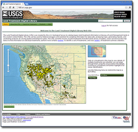
The Land Treatment Digital Library (LTDL) was created by the U.S. Geological Survey to catalog legacy land treatment information on Bureau of Land Management lands in the western United States. The LTDL can be used by federal managers and scientists for compiling information for data-calls, producing maps, generating reports, and conducting analyses at varying spatial and temporal scales. The LTDL currently houses thousands of treatments from BLM lands across 10 states. Users can browse a map to find information on individual treatments, perform more complex queries to identify a set of treatments, and view graphs of treatment summary statistics.
Suggested Citation
Pilliod, D., Welty, J., 2013, Land Treatment Digital Library: U.S. Geological Survey Data Series 806, HTML site, https://doi.org/10.3133/ds806.
ISSN: 2327-638X (online)
| Publication type | Report |
|---|---|
| Publication Subtype | USGS Numbered Series |
| Title | Land Treatment Digital Library |
| Series title | Data Series |
| Series number | 806 |
| DOI | 10.3133/ds806 |
| Year Published | 2013 |
| Language | English |
| Publisher | U.S. Geological Survey |
| Publisher location | Reston, VA |
| Contributing office(s) | Forest and Rangeland Ecosystem Science Center |
| Description | HTML site |
| Online Only (Y/N) | Y |
| Additional Online Files (Y/N) | N |


