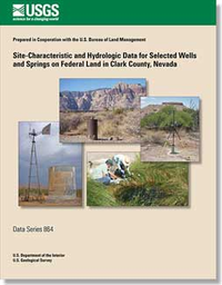
Site-characteristic and hydrologic data for selected wells and springs on Federal land in Clark County, Nevada

Data Series 864
Prepared in cooperation with the U.S. Bureau of Land Management
By:

Links

Abstract

Site-characteristic and hydrologic data for selected wells and springs on U.S. Bureau of Land Management, National Park Service, U.S. Fish and Wildlife Service, and U.S. Forest Service land in Clark County, Nevada, were updated in the U.S. Geological Survey’s National Water Information System (NWIS) to facilitate multi-agency research. Data were researched and reviewed, sites were visited, and NWIS data were updated for 231 wells and 198 springs, including 36 wells and 67 springs that were added to NWIS and 44 duplicate sites that were deleted. The site-characteristic and hydrologic data collected, reviewed, edited, and added to NWIS include locations, well water levels, spring discharges, and water chemistry. Site-characteristic and hydrologic data can be accessed from links to the NWIS web interface; data not available through the web interface are presented in appendixes to this report.

Study Area

Publication type Report
Publication Subtype USGS Numbered Series
Title Site-characteristic and hydrologic data for selected wells and springs on Federal land in Clark County, Nevada
Series title Data Series
Series number 864
DOI 10.3133/ds864
Year Published 2014
Language English
Publisher U.S. Geological Survey
Publisher location Reston, VA
Contributing office(s) Nevada Water Science Center
Description Report: iv, 18 p.; 2 Appendixes
Country United States
State Nevada
County Clark County
Datum North American Datum 1983
Projection Albers Equal Area Conic Projection
Online Only (Y/N) Y
Additional Online Files (Y/N) Y
Google Analytic Metrics Metrics page
Additional publication details