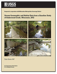
Stream geomorphic and habitat data from a baseline study of Underwood Creek, Wisconsin, 2012
Links
- Document: Report (20.2 MB pdf)
- Tables:
- Figure:
Location Map, Hydrograph Comparisons, and Photo Comparison
Figure 1, Figure 2, and Figure 3 (2.17 MB) - Additional Report Piece: Completed Field Forms (zip) (12 files, 198 MB)
- Companion Files:
-
Photos
Geomorphic and Habit Assessment Site Photos (108 files, 270 MB), River Walk-Through Photos
(307 files, 782 MB), and picasa39-setup.exe (14.6 MB) - USGS Underwood Creek - Return Flow Study (mpk) (252 MB)
- Downloads Directory includes completed field forms, data tables, figures, gis and photo data
-
Photos
Geomorphic and Habit Assessment Site Photos (108 files, 270 MB), River Walk-Through Photos
- Read Me: Read Me (22.5 MB pdf)
- Spatial Data: Final Geographic Information System Files (193 KB zip) (153 Files )
- Download citation as: RIS | Dublin Core
Abstract
Geomorphic and habitat data were collected along Underwood Creek as part of a larger study of stream water quality conditions in the greater Milwaukee, Wisconsin, area. The data were collected to characterize baseline physical conditions in Underwood Creek prior to a potential discharge of wastewater return flow to the stream from the city of Waukesha, Wis. Geomorphic and habitat assessments were conducted in the summer and fall of 2012 by the U.S. Geological Survey (USGS) in cooperation with the Milwaukee Metropolitan Sewerage District. The assessments used a transect based, reach scale assessment at a total of eight reaches—six reaches along Underwood Creek and two reaches along the Menomonee River upstream and downstream of its confluence with Underwood Creek. The reach scale assessment was an updated version of the USGS National Water Quality Assessment Program habitat assessment integrated with an intensive geomorphic assessment. Channel cross sections and longitudinal profiles were surveyed along each of the eight reaches, and discharge and water temperature were measured. Additionally, a geomorphic river walk-through was completed along a 10 kilometer reach that spanned the individual assessment reaches and the sections of channel between them. The assessments and river walk-through described channel and bank stability, channel shape and size, sediment and riparian conditions along these areas of Underwood Creek and the Menomonee River. Since the time of the data collection, focus has turned to other Lake Michigan tributary watersheds for possible Waukesha return-flow discharges; however, the data collected for this effort remains a valuable asset for the baseline characterization, design, and prioritization of planned stream rehabilitation activities in Underwood Creek. The data files presented in this report include a variety of formats including geographic information system files, spreadsheets, photos, and scans of field forms.
A subset of habitat-specific data collected during the baseline study can be retrieved through USGS BioData https://aquatic.biodata.usgs.gov/landing.action.
Suggested Citation
Young, B.M., Fitzpatrick, F.A., and Blount, J.D., 2015, Stream geomorphic and habitat data from a baseline study of Underwood Creek, Wisconsin, 2012: U.S. Geological Survey Data Series 947, 14 p., plus data files, https://dx.doi.org/10.3133/ds947.
ISSN: 2327-638X (online)
Study Area
Table of Contents
- Abstract
- Introduction
- Methods for Stream Geomorphic and Habitat Data Collection
- Stream Geomorphology and Habitat Data
- Summary
- Acknowledgments
- References Cited
| Publication type | Report |
|---|---|
| Publication Subtype | USGS Numbered Series |
| Title | Stream geomorphic and habitat data from a baseline study of Underwood Creek, Wisconsin, 2012 |
| Series title | Data Series |
| Series number | 947 |
| DOI | 10.3133/ds947 |
| Publication Date | December 07, 2015 |
| Year Published | 2015 |
| Language | English |
| Publisher | U.S. Geological Survey |
| Publisher location | Reston, VA |
| Contributing office(s) | Wisconsin Water Science Center |
| Description | Report: v, 14 p.; 3 Tables; Figures; ReadMe; Spatial Data; Photos; Downloads Directory |
| Country | United States |
| State | Wisconsin |
| Other Geospatial | Underwood Creek |
| Online Only (Y/N) | Y |
| Additional Online Files (Y/N) | Y |


