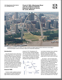
Flood of 1993—Mississippi River near the Jefferson National Expansion Memorial (Arch), St. Louis, Missouri
Links
- Document: Report (754 kB pdf)
- Download citation as: RIS | Dublin Core
Abstract
River-flow data have been collected on the Mississippi River at St. Louis near the Jefferson National Expansion Memorial (Arch) since 1861. Water at this location is excess river flow from 13 States and part of Canada (drainage area of about 697,000 square miles). Many disaster conditions, including floods and droughts, have affected this area; however, the flood of 1993 will be remembered not only for its intensity and duration, but as the largest flood in 150 years in the area.
Suggested Citation
Southard, R.E., Smith, B.J., 1995, Flood of 1993—Mississippi River near the Jefferson National Expansion Memorial (Arch), St. Louis, Missouri: U.S. Geological Survey Fact Sheet 188-95, 2 p., https://doi.org/10.3133/fs18895.
ISSN: 2327-6932 (online)
Table of Contents
- Introduction
- Flood of 1993
- References
| Publication type | Report |
|---|---|
| Publication Subtype | USGS Numbered Series |
| Title | Flood of 1993—Mississippi River near the Jefferson National Expansion Memorial (Arch), St. Louis, Missouri |
| Series title | Fact Sheet |
| Series number | 188-95 |
| DOI | 10.3133/fs18895 |
| Year Published | 1995 |
| Language | English |
| Publisher | U.S. Geological Survey |
| Publisher location | Reston, VA |
| Contributing office(s) | Missouri Water Science Center |
| Description | 2 p. |


