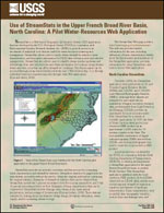
StreamStats is a Web-based Geographic Information System (GIS) application that was developed by the U.S. Geological Survey (USGS) in cooperation with Environmental Systems Research Institute, Inc. (ESRI) to provide access to an assortment of analytical tools that are useful for water-resources planning and management. StreamStats allows users to easily obtain streamflow statistics, basin characteristics, and descriptive information for USGS data-collection sites and selected ungaged sites. StreamStats also allows users to identify stream reaches upstream and downstream from user-selected sites and obtain information for locations along streams where activities occur that can affect streamflow conditions. This functionality can be accessed through a map-based interface with the user's Web browser or through individual functions requested remotely through other Web applications.


