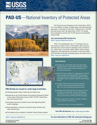
PAD-US—National Inventory of Protected Areas
Links
- More information: USGS Index Page
- Document: Report (3.86 MB pdf)
- Version History: Version (1.0 kB txt)
- Download citation as: RIS | Dublin Core
Abstract
The Gap Analysis Project produces data and tools that help meet critical national challenges such as biodiversity conservation, renewable energy development, climate change adaptation, and infrastructure investment. The Protected Areas Database of the United States (PAD-US) is the official inventory of public parks and other protected open space. Consisting of more than 7 billion acres in 436,000 land and marine units, the spatial data in PAD–US include areas managed by greater than 30,000 agencies and nonprofit organizations.
Suggested Citation
Gergely, K.J., and McKerrow, A., 2013, PAD-US—National inventory of protected areas (ver. 1.2, December 2020): U.S. Geological Survey Fact Sheet 2013–3086, 2 p., https://doi.org/10.3133/fs20133086.
ISSN: 2327-6932 (online)
Study Area
| Publication type | Report |
|---|---|
| Publication Subtype | USGS Numbered Series |
| Title | PAD-US—National inventory of protected areas |
| Series title | Fact Sheet |
| Series number | 2013-3086 |
| DOI | 10.3133/fs20133086 |
| Edition | Version 1.0: November 12, 2013; Version 1.1: August 4, 2016; Version 1.2: December 9, 2020 |
| Publication Date | November 12, 2013 |
| Year Published | 2013 |
| Language | English |
| Publisher | U.S. Geological Survey |
| Publisher location | Reston, VA |
| Contributing office(s) | Core Science Analytics, Synthesis, and Libraries, GAP Analysis Project |
| Description | 2 p. |
| Country | United States |
| Online Only (Y/N) | Y |
| Additional Online Files (Y/N) | N |


