Hampton roads regional Water-Quality Monitoring Program
Links
- Document: Report (1.62 MB pdf)
- Download citation as: RIS | Dublin Core
Introduction
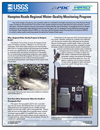
How much nitrogen, phosphorus, and suspended solids are contributed by the highly urbanized areas of the Hampton Roads region in Virginia to Chesapeake Bay? The answer to this complex question has major implications for policy decisions, resource allocations, and efforts aimed at restoring clean waters to Chesapeake Bay and its tributaries. To quantify the amount of nitrogen, phosphorus, and suspended solids delivered to the bay from this region, the U.S. Geological Survey has partnered with the Hampton Roads Sanitation District (HRSD), in cooperation with the Hampton Roads Planning District Commission (HRPDC), to conduct a water-quality monitoring program throughout the Hampton Roads region.
Suggested Citation
Porter, A.J., and Jastram, J.D., 2016, Hampton roads regional Water-Quality Monitoring Program: U.S. Geological Survey Fact Sheet 2016–3095, 2 p., https://dx.doi.org/10.3133/fs20163095.
ISSN: 2327-6932 (online)
ISSN: 2327-6916 (print)
Study Area
Table of Contents
- Why a Regional Water-Quality Program in Hampton Roads?
- How Does Urban Stormwater Affect the Health of Chesapeake Bay?
- How Does the Monitoring Program Work?
| Publication type | Report |
|---|---|
| Publication Subtype | USGS Numbered Series |
| Title | Hampton roads regional Water-Quality Monitoring Program |
| Series title | Fact Sheet |
| Series number | 2016-3095 |
| DOI | 10.3133/fs20163095 |
| Publication Date | December 02, 2016 |
| Year Published | 2016 |
| Language | English |
| Publisher | U.S. Geological Survey |
| Publisher location | Reston, VA |
| Contributing office(s) | Virginia Water Science Center |
| Description | 2 p. |
| First page | 1 |
| Last page | 2 |
| Country | United States |
| State | Virginia |
| Online Only (Y/N) | N |


