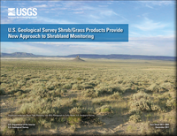
U.S. Geological Survey shrub/grass products provide new approach to shrubland monitoring
Links
- Document: Report (1 MB pdf)
- Download citation as: RIS | Dublin Core
Abstract
In the Western United States, shrubland ecosystems provide vital ecological, hydrological, biological, agricultural, and recreational services. However, disturbances such as livestock grazing, exotic species invasion, conversion to agriculture, climate change, urban expansion, and energy development are altering these ecosystems.
Improving our understanding of how shrublands are distributed, where they are changing, the extent of the historical change, and likely future change directions is critical for successful management of these ecosystems. Remote-sensing technologies provide the most likely data source for large-area monitoring of ecosystem disturbance—both near-real time and historically. A monitoring framework supported by remote-sensing data can offer efficient and accurate analysis of change across a range of spatial and temporal scales.
The U.S. Geological Survey has been working to develop new remote-sensing data, tools, and products to characterize and monitor these changing shrubland landscapes. Nine individual map products (components) have been developed that quantify the percent of shrub, sagebrush, big sagebrush, herbaceous, annual herbaceous, litter, bare ground, shrub height, and sagebrush height at 1-percent intervals in each 30-meter grid cell. These component products are designed to be combined and customized to widely support different applications in rangeland monitoring, analysis of wildlife habitat, resource inventory, adaptive management, and environmental review.
Suggested Citation
Young, S.M., 2017, U.S. Geological Survey shrub/grass products provide new approach to shrubland monitoring: U.S. Geological Fact Sheet 2017–3084, 4 p., https://doi.org/10.3133/fs20173084.
ISSN: 2327-6932 (online)
ISSN: 2327-6916 (print)
Table of Contents
- Managing Landscapes with a Landscape Lens
- Product Characteristics
- Quantifying Historical Change Through the Landsat Archive
- Telling the Monitoring Story of Every Western Pixel
| Publication type | Report |
|---|---|
| Publication Subtype | USGS Numbered Series |
| Title | U.S. Geological Survey shrub/grass products provide new approach to shrubland monitoring |
| Series title | Fact Sheet |
| Series number | 2017-3084 |
| DOI | 10.3133/fs20173084 |
| Publication Date | December 11, 2017 |
| Year Published | 2017 |
| Language | English |
| Publisher | U.S. Geological Survey |
| Publisher location | Reston, VA |
| Contributing office(s) | Earth Resources Observation and Science (EROS) Center |
| Description | 4 p. |
| Online Only (Y/N) | N |


