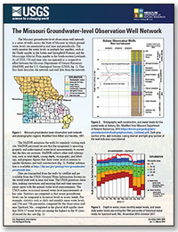
The Missouri Groundwater-level Observation Network
Links
- Document: Report (5.54 MB pdf)
- Version History: Version History (1 MB txt)
- Download citation as: RIS | Dublin Core
Abstract
The Missouri groundwater-level observation well network is a series of wells across the State of Missouri in which groundwater levels are monitored in real time and periodically. The wells monitor the water levels in multiple key aquifers, such as the Ozark aquifer in the Salem and Springfield Plateaus and the Mississippi Alluvial Plain aquifer in the South-eastern Lowlands. As of 2018, 150 real-time sites are operated as a cooperative effort between the Missouri Department of Natural Resources (MoDNR) and the U.S. Geological Survey. This fact sheet describes the network and well data from the network.
Suggested Citation
Smith, D.C., 2019, The Missouri groundwater-level observation well network (ver. 1.1, March 22, 2019): U.S. Geological Survey Fact Sheet 2019–3009, 2 p., https://doi.org/10.3133/fs20193009.
ISSN: 2327-6932 (online)
ISSN: 2327-6916 (print)
Study Area
| Publication type | Report |
|---|---|
| Publication Subtype | USGS Numbered Series |
| Title | The Missouri groundwater-level observation network |
| Series title | Fact Sheet |
| Series number | 2019-3009 |
| DOI | 10.3133/fs20193009 |
| Edition | Version 1.0: March 18, 2019; Version 1.1: March 22, 2019 |
| Publication Date | March 18, 2019 |
| Year Published | 2019 |
| Language | English |
| Publisher | U.S. Geological Survey |
| Publisher location | Reston, VA |
| Contributing office(s) | Central Midwest Water Science Center |
| Description | 2 p. |
| Country | United States |
| State | Missouri |
| Online Only (Y/N) | N |
| Additional Online Files (Y/N) | N |


