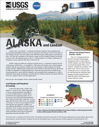
Alaska and Landsat
Links
- Document: Report (3.15 MB pdf) , HTML , XML
- Version History: Version History (8.30 kB txt)
- Download citation as: RIS | Dublin Core
Abstract
Alaska’s landscapes are changing at a more rapid rate than those of the lower 48. Its large size makes the collection of aerial surveys—a biannual occurrence for the conterminous United States—cost-prohibitive. That means the Landsat series of land imaging satellites offer the only publicly available, up-to-date imagery of land conditions for Alaska. Landsat satellites underpin public and private sector decisions in the State and across the Nation for effective adaptation to changing landscapes.
Suggested Citation
U.S. Geological Survey, 2020, Alaska and Landsat (ver. 1.1, December 2022): U.S. Geological Survey Fact Sheet 2020–3068, 2 p., https://doi.org/10.3133/fs20203068.
ISSN: 2327-6932 (online)
ISSN: 2327-6916 (print)
Study Area
Table of Contents
- Land Change and Permafrost Accounting
- Coastlines and Fisheries
- Wildfire and Disaster Response
- Landsat—Critical Information Infrastructure for the Nation
- References Cited
| Publication type | Report |
|---|---|
| Publication Subtype | USGS Numbered Series |
| Title | Alaska and Landsat |
| Series title | Fact Sheet |
| Series number | 2020-3068 |
| DOI | 10.3133/fs20203068 |
| Edition | Version 1.0: December 21, 2020; Version 1.1: December 12, 2022 |
| Publication Date | December 21, 2020 |
| Year Published | 2020 |
| Language | English |
| Publisher | U.S. Geological Survey |
| Publisher location | Reston, VA |
| Contributing office(s) | Earth Resources Observation and Science (EROS) Center |
| Description | 2 p. |
| Country | United States |
| State | Alaska |
| Online Only (Y/N) | N |


