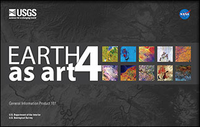
Earth as art 4
Links
- Document: Report (36.8 MB pdf)
- Download citation as: RIS | Dublin Core
Abstract
Landsat 8 is the latest addition to the long-running series of Earth-observing satellites in the Landsat program that began in 1972. The images featured in this fourth installment of the Earth As Art collection were all acquired by Landsat 8. They show our planet’s diverse landscapes with remarkable clarity.
Landsat satellites see the Earth as no human can. Not only do they acquire images from the vantage point of space, but their sensors record infrared as well as visible wavelengths of light. The resulting images often reveal “hidden” details of the Earth’s land surface, making them invaluable for scientific research.
As with previous Earth As Art exhibits, these Landsat images were selected solely for their aesthetic appeal. Many of the images have been manipulated to enhance color variations or details. They are not intended for scientific interpretation—only for your viewing pleasure. What do you see in these unique glimpses of the Earth’s continents, islands, and coastlines?
Suggested Citation
U.S. Geological Survey, 2016, Earth as art 4: U.S. Geological Survey General Information Product 161, 20 p., https://dx.doi.org/10.3133/gip161.
ISSN: 2332-354X (online)
ISSN: 2332-3531 (print)
| Publication type | Report |
|---|---|
| Publication Subtype | USGS Numbered Series |
| Title | Earth as art 4 |
| Series title | General Information Product |
| Series number | 161 |
| DOI | 10.3133/gip161 |
| Publication Date | March 29, 2016 |
| Year Published | 2016 |
| Language | English |
| Publisher | U.S. Geological Survey |
| Publisher location | Reston, VA |
| Contributing office(s) | Earth Resources Observation and Science (EROS) Center |
| Description | 24 p. |
| Online Only (Y/N) | N |
| Additional Online Files (Y/N) | N |


