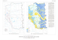
Hydrogeologic maps of the central Oklahoma aquifer, Oklahoma
Links
- Plates:
- NGMDB Index Page: National Geologic Map Database Index Page (html)
- Superseded Publications:
- Download citation as: RIS | Dublin Core
Abstract
This report presents hydrogeologic maps of the Central Oklahoma aquifer. The maps were prepared by measuring water levels in wells during the winder of 1986 and 1987; examination of geophysical logs to determine the altitudes of the top of selected geologic units and the base of fresh ground water; and compilation of existing information on the stratigraphy of selected geologic units and the base of fresh ground water.
Suggested Citation
Christenson, S.C., Morton, R.B., Mesander, B.A., 1992, Hydrogeologic maps of the central Oklahoma aquifer, Oklahoma: U.S. Geological Survey Hydrologic Atlas 724, 3 Plates: 40.90 × 28.42 inches or smaller, https://doi.org/10.3133/ha724.
Study Area
| Publication type | Report |
|---|---|
| Publication Subtype | USGS Numbered Series |
| Title | Hydrogeologic maps of the central Oklahoma aquifer, Oklahoma |
| Series title | Hydrologic Atlas |
| Series number | 724 |
| DOI | 10.3133/ha724 |
| Year Published | 1992 |
| Language | English |
| Publisher | U.S. Geological Survey |
| Contributing office(s) | Oklahoma Water Science Center |
| Description | 3 Plates: 40.90 × 28.42 inches or smaller |
| Country | United States |
| State | Oklahoma |
| Other Geospatial | Oklahoma aquifer |
| Scale | 250000 |
| Online Only (Y/N) | N |
| Additional Online Files (Y/N) | N |

