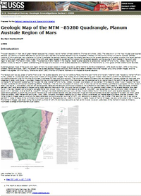
The polar deposits on Mars are of great interest because they probably record martian climate variations (Thomas and others, 1992). The area shown on this map includes polar layered deposits with distinct low-albedo features and a sharp boundary between the layered deposits and the moderately cratered unit that forms the floor of Chasma Australe. Detailed mapping of this quadrangle was undertaken to further investigate the geologic relations between the albedo features and the layered deposits and to better constrain the recent geologic history of the south polar region. Dark dunes in the north polar region appear to be derived from erosion of the layered deposits, but the source of dark material in the south polar region is less clear (Thomas and Weitz, 1989). The presence of dark material in the brighter, redder layered deposits is paradoxical (Herkenhoff and Murray, 1990a); resolving this paradox is likely to result in a better understanding of the origin and evolution of the layered deposits and, therefore, the mechanisms by which global climate variations are recorded. Published geologic maps of the south polar region of Mars have been based on images acquired by either Mariner 9 (Condit and Soderblom, 1978; Scott and Carr, 1978) or the Viking Orbiters (Tanaka and Scott, 1987). The extent of the layered deposits mapped previously from Mariner 9 data is different from that mapped using Viking Orbiter images, and the present map agrees with the map by Tanaka and Scott (1987): the floor of Chasma Australe is not mapped as layered deposits. The residual polar ice cap, areas of partial frost cover, the layered deposits, and two nonvolatile surface units - the dust mantle and the dark material - were mapped by Herkenhoff and Murray (1990a) at 1:2,000,000 scale using a color mosaic of Viking Orbiter images. This mosaic and an additional Viking color mosaic were used to confirm the identification of the nonvolatile Amazonian units for this map and to test hypotheses for their origin and evolution. The colors and albedos of these units, as measured in places outside this map area, are presented in table 1 and figure 1. Accurately measuring the color and albedo of the units in this map area was not possible due to low signal/noise in the part of the red/violet mosaic (corrected for atmospheric scattering) that includes this area (Herkenhoff and Murray, 1990a). However, color/albedo unit boundaries in this area are visible in color mosaics that have not been corrected for atmospheric scattering effects. Therefore, while the color and albedo of various units on this map cannot be precisely quantified and compared with the values in table 1 and figure 1, color/albedo units can still be recognized. Because the resolution of the color mosaics is not sufficient to map these units in detail at 1:500,000 scale, contacts between them were recognized and mapped using higher resolution black-and-white Viking and Mariner 9 images. Only two possible impact craters in the layered deposits have been found in the area mapped; both are slightly elongate rather than circular. One, 1.6 km in diameter at lat 86.6° S., long 268°, was recognized by Plaut and others (1988); the other, about 3 km in diameter, is at lat 82.8° S., long 277°. Although the crater statistics are poor (only 16 likely impact craters found in the entire south polar layered deposits), these observations generally support the conclusions that the south polar layered deposits are Late Amazonian in age and that some areas have been exposed for at least 120 million years (Plaut and others, 1988; Herkenhoff and Murray, 1992, 1994). However, the recent cratering flux on Mars is poorly constrained, so inferred ages of surface units are uncertain. The Viking Orbiter 2 images used to construct the base were taken during the southern summer of 1977, with resolutions no better than 180 m/pixel. (The "less than 100 m per picture element" in Notes on Base of the controlled photomosaic base [U.S. Geological Survey, 1986] is incorrect.) A digital mosaic of Mariner 9 images was also constructed to aid in mapping. The Mariner 9 images were taken during the southern summer of 1971-72 and have resolutions as high as 90 m/pixel. However, usefulness of the Mariner 9 mosaic is limited by incomplete coverage and atmospheric dust opacity.


