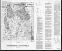
Mineral resource potential map of the South Sierra Wilderness and the South Sierra Roadless Area, Inyo and Tulare Counties, California
Links
- More information: USGS Index Page (html)
- Document: Report (pdf)
- NGMDB Index Page: National Geologic Map Database Index Page (html)
- Download citation as: RIS | Dublin Core
Abstract
Suggested Citation
Diggles, M.F., 1987, Mineral resource potential map of the South Sierra Wilderness and the South Sierra Roadless Area, Inyo and Tulare Counties, California: U.S. Geological Survey Miscellaneous Field Studies Map 1913, 1 Plate: 41.01 x 33.69 inches, https://doi.org/10.3133/mf1913A.
Study Area
| Publication type | Report |
|---|---|
| Publication Subtype | USGS Numbered Series |
| Title | Mineral resource potential map of the South Sierra Wilderness and the South Sierra Roadless Area, Inyo and Tulare Counties, California |
| Series title | Miscellaneous Field Studies Map |
| Series number | 1913 |
| Chapter | A |
| DOI | 10.3133/mf1913A |
| Year Published | 1987 |
| Language | English |
| Publisher | U.S. Geological Survey |
| Publisher location | Reston, VA |
| Contributing office(s) | Western Mineral and Environmental Resources Science Center |
| Description | 1 Plate: 41.01 x 33.69 inches |
| Country | United States |
| State | California |
| County | Inyo County, Tulare County |
| Other Geospatial | South Sierra Wilderness;South Sierra Roadless Area |
| Datum | National Geodetic Vertical Datum of 1929 |
| Scale | 48000 |
| Additional Online Files (Y/N) | Y |


