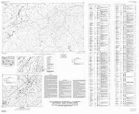
Gold occurrences in the Greenville 1° x 2° quadrangle, South Carolina, Georgia, and North Carolina
Links
- Plate: Plate 1 (pdf)
- NGMDB Index Page: National Geologic Map Database Index Page
- Download citation as: RIS | Dublin Core
Abstract
All of the gold mines, prospects, placers, and occurrences known in the Greenville 1° x 2° quadrangle are tabulated in this report. The table lists, in consecutive order by county (fig. 1), the map number of each feature, which is located either on the accompanying Greenville 1° x 2° quadrangle map or figure 2. The known name of the feature; the 7.5' topographic map on the which the gold site is located (if known, within 25 ft or 7.6 m), the Universal Transverse Mercator (UTM) northing and easting grid coordinates from the appropriate 7.5' topographic map; the commodity; remarks; and references are also listed. Some locations are known, but many sites are not verified and their locations are only approximate. References are listed in References Cited and referred to by number to save space.
Suggested Citation
D’Agostino, J.P., Mason, G.T., Zupan, A., Maybin, A.H., German, J.M., Abrams, C.E., 1994, Gold occurrences in the Greenville 1° x 2° quadrangle, South Carolina, Georgia, and North Carolina: U.S. Geological Survey Miscellaneous Field Studies Map 2215, 1 Plate: 49.54 x 40.79 inches, https://doi.org/10.3133/mf2215C.
Study Area
| Publication type | Report |
|---|---|
| Publication Subtype | USGS Numbered Series |
| Title | Gold occurrences in the Greenville 1° x 2° quadrangle, South Carolina, Georgia, and North Carolina |
| Series title | Miscellaneous Field Studies Map |
| Series number | 2215 |
| Chapter | C |
| DOI | 10.3133/mf2215C |
| Year Published | 1994 |
| Language | English |
| Publisher | U.S. Geological Survey |
| Publisher location | Denver, CO |
| Description | 1 Plate: 49.54 x 40.79 inches |
| Country | United States |
| State | Georgia, North Carolina, South Carolina |
| Other Geospatial | Greenville 1° x 2° quadrangle |
| Scale | 250000 |

