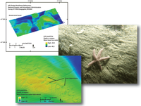
Surficial geology of the sea floor in Central Rhode Island Sound Southeast of Point Judith, Rhode Island
Links
- More information: USGS Index Page (html)
- Download citation as: RIS | Dublin Core
Abstract
Suggested Citation
McMullen, K., Poppe, L., Ackerman, S., Blackwood, D., Schaer, J., Nadeau, M., Wood, D., 2011, Surficial geology of the sea floor in Central Rhode Island Sound Southeast of Point Judith, Rhode Island: U.S. Geological Survey Open-File Report 2011-1005, HTML Document, https://doi.org/10.3133/ofr20111005.
ISSN: 2331-1258 (online)
Study Area
| Publication type | Report |
|---|---|
| Publication Subtype | USGS Numbered Series |
| Title | Surficial geology of the sea floor in Central Rhode Island Sound Southeast of Point Judith, Rhode Island |
| Series title | Open-File Report |
| Series number | 2011-1005 |
| DOI | 10.3133/ofr20111005 |
| Year Published | 2011 |
| Language | English |
| Publisher | U.S. Geological Survey |
| Publisher location | Reston, VA |
| Contributing office(s) | Woods Hole Coastal and Marine Science Center |
| Description | HTML Document |
| Country | United States |
| Other Geospatial | Central Rhode Island Sound;Southeast Of Point Judith;Rhode Island |


