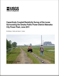
Capacitively coupled resistivity survey of the levee surrounding the Omaha Public Power District Nebraska City Power Plant, June 2011
Links
- More information: USGS Index Page (html)
- Download citation as: RIS | Dublin Core
Abstract
Suggested Citation
Burton, B., Cannia, J.C., 2011, Capacitively coupled resistivity survey of the levee surrounding the Omaha Public Power District Nebraska City Power Plant, June 2011: U.S. Geological Survey Open-File Report 2011-1211, iv, 9 p.; Appendix; Digital Capacitively Coupled Resistivity Data: processed, binned (5-m bin size), processed, inverted model (2.5-m cell size), https://doi.org/10.3133/ofr20111211.
ISSN: 2331-1258 (online)
Study Area
| Publication type | Report |
|---|---|
| Publication Subtype | USGS Numbered Series |
| Title | Capacitively coupled resistivity survey of the levee surrounding the Omaha Public Power District Nebraska City Power Plant, June 2011 |
| Series title | Open-File Report |
| Series number | 2011-1211 |
| DOI | 10.3133/ofr20111211 |
| Year Published | 2011 |
| Contributing office(s) | Crustal Geophysics and Geochemistry Science Center |
| Description | iv, 9 p.; Appendix; Digital Capacitively Coupled Resistivity Data: processed, binned (5-m bin size), processed, inverted model (2.5-m cell size) |
| Online Only (Y/N) | Y |
| Additional Online Files (Y/N) | Y |


