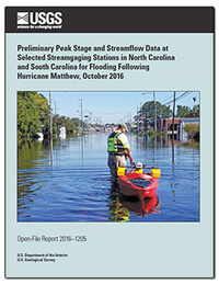
Preliminary peak stage and streamflow data at selected streamgaging stations in North Carolina and South Carolina for flooding following Hurricane Matthew, October 2016
Links
- Document: Report (4.31 MB pdf)
- Download citation as: RIS | Dublin Core
Abstract
The passage of Hurricane Matthew across the central and eastern regions of North Carolina and South Carolina during October 7–9, 2016, resulted in heavy rainfall that caused major flooding in parts of the eastern Piedmont in North Carolina and coastal regions of both States. Rainfall totals of 3 to 8 inches and 8 to more than 15 inches were widespread throughout the central and eastern regions, respectively. U.S. Geological Survey streamgages recorded peaks of record at 26 locations, including 11 sites with long-term periods of 30 or more years of record. A total of 44 additional locations had peak streamflows that ranked in the top 5 for the period of record. Additionally, among 23 U.S. Geological Survey streamgages within the affected basins in North Carolina where stage-only data are collected, new peak stages were recorded at 5 locations during the flooding. U.S. Geological Survey personnel made 102 streamflow measurements at 60 locations in both States to verify, update, or extend existing rating curves (which are used to determine stage-discharge relations) during the October 2016 flood event.
Suggested Citation
Weaver, J.C., Feaster, T.D., and Robbins, J.C., 2016, Preliminary peak stage and streamflow data at selected streamgaging stations in North Carolina and South Carolina for flooding following Hurricane Matthew, October 2016: U.S. Geological Survey Open-File Report 2016–1205, 38 p., https://doi.org/10.3133/ofr20161205.
ISSN: 2331-1258 (online)
Study Area
Table of Contents
- Abstract
- Introduction
- General Weather Conditions and Precipitation Causing the October 2016 Flooding
- Methods Used to Collect Streamflow Data
- Peak Streamflow and Stage
- Comparison of the October 2016 Flood to Past Floods
- Summary
- References Cited
| Publication type | Report |
|---|---|
| Publication Subtype | USGS Numbered Series |
| Title | Preliminary peak stage and streamflow data at selected streamgaging stations in North Carolina and South Carolina for flooding following Hurricane Matthew, October 2016 |
| Series title | Open-File Report |
| Series number | 2016-1205 |
| DOI | 10.3133/ofr20161205 |
| Publication Date | December 19, 2016 |
| Year Published | 2016 |
| Language | English |
| Publisher | U.S. Geological Survey |
| Publisher location | Reston, VA |
| Contributing office(s) | South Atlantic Water Science Center |
| Description | v, 38 p. |
| Country | United States |
| State | North Carolina, South Carolina |
| Online Only (Y/N) | Y |


