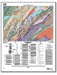
Bedrock geologic map of the Littleton and Lower Waterford quadrangles, Essex and Caledonia Counties, Vermont, and Grafton County, New Hampshire
Links
- Sheet: Geologic Map (24.1 MB pdf)
- Databases:
- Geologic Map (ArcGIS 10.5) (49.3 KB zip) - Littleton and Lower Waterford, Vermont, and New Hampshire, Geologic Map
- Database (1.30 MB zip) - Littleton and Lower Waterford, Vermont, and New Hampshire, Geodatabase
- Metadata: Metadata (67.1 KB zip) - Littleton and Lower Waterford, Vermont, and New Hampshire, Metadata
- Spatial Data: Base Map (10.8 MB zip) - Littleton and Lower Waterford, Vermont, and New Hampshire, Base Map
- Download citation as: RIS | Dublin Core
Abstract
The bedrock geologic map of the Littleton and Lower Waterford quadrangles covers an area of approximately 107 square miles (277 square kilometers) north and south of the Connecticut River in east-central Vermont and adjacent New Hampshire. This map was created as part of a larger effort to produce a new bedrock geologic map of Vermont through the collection of field data at a scale of 1:24,000. A large part of the map area consists of the Bronson Hill anticlinorium, a post-Early Devonian structure that is cored by metamorphosed Cambrian to Devonian sedimentary, volcanic, and plutonic rocks. The northwestern part of the map is divided by the Monroe fault which separates Early Devonian rocks of the Connecticut Valley-Gaspé trough from rocks of the Bronson Hill anticlinorium.
The Bronson Hill anticlinorium is the apex of the Middle Ordovician to earliest-Silurian Bronson Hill magmatic arc that contains the Ammonoosuc Volcanics, Partridge Formation, and Oliverian Plutonic suite, and extends from Maine, down the eastern side of the Connecticut River in New Hampshire, to Long Island Sound. The deformed and partially eroded arc is locally overlain by a relatively thin Silurian section of metasedimentary rocks (Clough Quartzite and Fitch Formation) that thickens to the east. The Silurian section near Littleton is disconformably overlain by a thicker, Lower Devonian section that includes mostly metasedimentary rocks and minor metavolcanic rocks of the Littleton Formation. The Bronson Hill anticlinorium is bisected by a series of northeast-southwest trending Mesozoic normal faults. Primarily among them is the steeply northwest-dipping Ammonoosuc fault that divides older and younger units (upper and lower sections) of the Ammonoosuc Volcanics. The Ammonoosuc Volcanics are lithologically complex and predominantly include interlayered and interfingered rhyolitic to basaltic volcanic and volcaniclastic rocks, as well as lesser amounts of metamorphic and metasedimentary rocks. The Ammonoosuc Volcanics overlies the Albee Formation that consists of interlayered feldspathic sandstone, siltstone, pelite, and slate.
During the Late Ordovician, a series of arc-related plutons intruded the Ammonoosuc Volcanics, including the Whitefield pluton to the east, the Scrag granite of Billing (1937) in the far southeastern corner of the map, the Highlandcroft Granodiorite just to the west of the Ammonoosuc fault, and the Joslin Turn tonalite (just north of the Connecticut River). To the east of the Monroe fault lies the late Silurian Comerford Intrusive Complex, which consists of metamorphosed gabbro, diorite, tonalite, aplitic tonalite, and crosscutting diabase dikes. Abundant mafic dikes of the Comerford Intrusive Complex intruded the Albee Formation and Ammonoosuc Volcanics well east of the Monroe fault.
This report consists of a single geologic map sheet and an online geographic information systems database that includes contacts of bedrock geologic units, faults, outcrops, and structural geologic information.
Suggested Citation
Rankin, D.W., 2018, Bedrock geologic map of the Littleton and Lower Waterford quadrangles, Essex and Caledonia Counties, Vermont, and Grafton County, New Hampshire: U.S. Geological Survey Open-File Report 2018–1087, 1 sheet, scale 1:24,000, https://doi.org/10.3133/ofr20181087.
ISSN: 2331-1258 (online)
Study Area
Table of Contents
- Correlation of Map Units
- Description of Map Units
- Explanation of Map Symbols
- References Cited
| Publication type | Report |
|---|---|
| Publication Subtype | USGS Numbered Series |
| Title | Bedrock geologic map of the Littleton and Lower Waterford quadrangles, Essex and Caledonia Counties, Vermont, and Grafton County, New Hampshire |
| Series title | Open-File Report |
| Series number | 2018-1087 |
| DOI | 10.3133/ofr20181087 |
| Publication Date | June 13, 2018 |
| Year Published | 2018 |
| Language | English |
| Publisher | U.S. Geological Survey |
| Publisher location | Reston, VA |
| Contributing office(s) | Eastern Geology and Paleoclimate Science Center |
| Description | Sheet: 36.00 x 45.82 inches; Geologic Map: ArcGIS 10.5 zip; Geodatabase; Metadata; Base Map |
| Country | United States |
| State | New Hampshire, Vermont |
| County | Caledonia County, Grafton County, Essex County |
| Other Geospatial | Littleton Quadrangle, Lower Waterford Quadrangle |
| Online Only (Y/N) | Y |
| Additional Online Files (Y/N) | N |

