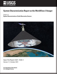
System Characterization Report on the WorldView-3 Imager
Links
- Document: Report (20.1 MB) , XML
- Larger Work: This publication is Chapter I of System characterization of Earth observation sensors
- Version History: Version History (878 B txt)
- Download citation as: RIS | Dublin Core
Executive Summary
This report addresses system characterization of the Maxar WorldView-3 satellite and is part of a series of system characterization reports produced and delivered by the U.S. Geological Survey Earth Resources Observation and Science Cal/Val Center of Excellence in 2020. These reports present and detail the methodology and procedures for characterization; present technical and operational information about the specific sensing system being evaluated; and provide a summary of test measurements, data retention practices, data analysis results, and conclusions.
WorldView-3 is a high-resolution multispectral satellite launched in 2014 by Maxar Technologies on an Atlas V launch vehicle from Vandenberg Air Force Base in California for Earth resources monitoring. WorldView-3 provides substantial technical improvements to previous WorldView satellites, including spectral bands, ground sample distance, and swath. The WorldView-3 satellite was designed and built by Lockheed Martin for Maxar Technologies using the BCP–5000 bus with the WorldView-3 Imager and the Clouds, Aerosols, Vapors, Ice, and Snow sensor. The high-resolution WorldView-3 Imager is the main instrument, and the Clouds, Aerosols, Vapors, Ice, and Snow sensor provides additional data on obscurants and other atmospheric effects used in data production. More information on Maxar WorldView satellites and sensors is available within the “2020 Joint Agency Commercial Imagery Evaluation—Remote Sensing Satellite Compendium” and from the manufacturer at https://www.maxar.com/.
The Earth Resources Observation and Science Cal/Val Center of Excellence system characterization team completed data analyses to characterize the geometric (interior and exterior), radiometric, and spatial performances. Results of these analyses indicate that WorldView-3 has a range of interior geometric performance of −0.09 (−0.07 pixel) to 0.24 meter (0.19 pixel) in band-to-band registration; an exterior geometric performance in the range of a −21.10- (−2.11 pixels) to 28.23-meter (2.82 pixels) offset in comparison to Sentinel-2; a radiometric performance in the range of −0.121 to 1.420 (offset and slope); and a spatial performance in the range of 1.2 to 1.7 pixels at full width at half maximum with a modulation transfer function at a Nyquist frequency in the range of 0.093 to 0.185.
Suggested Citation
Cantrell, S.J., Christopherson, J.B., Anderson, C., Stensaas, G.L., Ramaseri Chandra, S.N., Kim, M., and Park, S., 2021, System characterization report on the WorldView-3 Imager (ver. 1.1, October 2021), chap. I of Ramaseri Chandra, S.N., comp., System characterization of Earth observation sensors: U.S. Geological Survey Open-File Report 2021–1030, 29 p., https://doi.org/10.3133/ofr20211030I.
ISSN: 2331-1258 (online)
Table of Contents
- Executive Summary
- Introduction
- System Description
- Procedures
- Measurements
- Analysis
- Summary and Conclusions
- Selected References
| Publication type | Report |
|---|---|
| Publication Subtype | USGS Numbered Series |
| Title | System characterization report on the WorldView-3 Imager |
| Series title | Open-File Report |
| Series number | 2021-1030 |
| Chapter | I |
| DOI | 10.3133/ofr20211030I |
| Edition | Version 1.0: June 2021; Version 1.1: October 2021 |
| Publication Date | June 07, 2021 |
| Year Published | 2021 |
| Language | English |
| Publisher | U.S. Geological Survey |
| Publisher location | Reston, VA |
| Contributing office(s) | Earth Resources Observation and Science (EROS) Center |
| Description | Report: v, 29 p.; Version History |
| Online Only (Y/N) | Y |


