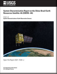
System Characterization Report on the China-Brazil Earth Resources Satellite-4A (CBERS–4A)
Links
- Document: Report (12.2 MB pdf)
- Larger Work: This publication is Chapter J of System characterization of Earth observation sensors
- Download citation as: RIS | Dublin Core
Executive Summary
This report addresses system characterization of the China-Brazil Earth Resources Satellite-4A (CBERS–4A) multispectral remote sensing satellite and is part of a series of system characterization reports produced and delivered by the U.S. Geological Survey Earth Resources Observation and Science Cal/Val Center of Excellence in 2021. These reports present and detail the methodology and procedures for characterization; present technical and operational information about the specific sensing system being evaluated; and provide a summary of test measurements, data retention practices, data analysis results, and conclusions.
CBERS–4A is a joint Chinese-Brazilian medium-resolution satellite launched in December 2019 by the China National Space Agency/National Institute for Space Research (Brazil) on a Chang Zheng 4B rocket from the Taiyuan Satellite Launch Center for Earth resources monitoring. The CBERS–4A mission continues the CBERS mission that has been in continual operation since the launch of CBERS–1 in 1999.
The CBERS–4A satellite was designed and built by Academia Chinesa de Tecnologia Espacial/National Institute for Space Research and uses the Phoenix-Eye bus. CBERS–4A carries the multispectral camera and wide field imager sensors for medium-resolution land imaging and the wide swath panchromatic and multispectral camera sensor for high-resolution land imaging. This assessment focused on the multispectral camera sensor only. More information on CBERS sensors is available in the “2020 Joint Agency Commercial Imagery Evaluation—Remote Sensing Satellite Compendium” and at https://www.gov.br/pt-br/servicos/obter-imagens-de-sensoriamento-remoto-da-terra-geradas-pelo-satelite-cbers-04a.
The Earth Resources Observation and Science Cal/Val Center of Excellence system characterization team completed data analyses to characterize the geometric (interior and exterior), radiometric, and spatial performances. Results of these analyses indicate that CBERS–4A provides an interior (band-to-band) geometric performance in the range of −0.02 to −0.16 pixel; an exterior geometric accuracy performance of −22.02 (−1.47 pixels) to −16.06 meters (−1.07 pixels); a radiometric accuracy performance of –0.006 to 0.925 (offset and slope); and a spatial performance for relative edge response in the range of 0.39 to 0.44, for full width at half maximum in the range of 2.38 to 2.56 pixels, and for a modulation transfer function at a Nyquist frequency in the range of 0.001 to 0.013.
Suggested Citation
Vrabel, J.C., Stensaas, G.L., Anderson, C., Christopherson, J., Kim, M., Park, S., and Cantrell, S., 2021, System characterization report on the China-Brazil Earth Resources Satellite-4A (CBERS–4A), chap. J of Ramaseri Chandra, S.N., comp., System characterization of Earth observation sensors: U.S. Geological Survey Open-File Report 2021–1030, 35 p., https://doi.org/10.3133/ofr20211030J.
ISSN: 2331-1258 (online)
Table of Contents
- Executive Summary
- Introduction
- System Description
- Procedures
- Measurements
- Analysis
- Summary and Conclusions
- Selected References
| Publication type | Report |
|---|---|
| Publication Subtype | USGS Numbered Series |
| Title | System characterization report on the China-Brazil Earth Resources Satellite-4A (CBERS–4A) |
| Series title | Open-File Report |
| Series number | 2021-1030 |
| Chapter | J |
| DOI | 10.3133/ofr20211030J |
| Publication Date | August 26, 2021 |
| Year Published | 2021 |
| Language | English |
| Publisher | U.S. Geological Survey |
| Publisher location | Reston, VA |
| Contributing office(s) | Earth Resources Observation and Science (EROS) Center |
| Description | v, 35 p. |
| Online Only (Y/N) | Y |


