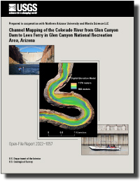
Channel Mapping of the Colorado River from Glen Canyon Dam to Lees Ferry in Glen Canyon National Recreation Area, Arizona
Links
- Document: Report (3 MB pdf)
- Data Release: Channel mapping Glen Canyon Dam to Lees Ferry in Glen Canyon National Recreation Area, Arizona - Data
- Download citation as: RIS | Dublin Core
Abstract
Bathymetric and topographic data were collected from May 2013 to February 2016 along the 15.84-mile reach of the Colorado River spanning from Glen Canyon Dam to Lees Ferry in Glen Canyon National Recreation Area, Arizona. Channel bathymetry was mapped using multibeam and singlebeam echo sounders; subaerial topography was mapped using a combination of ground-based total stations and aerial photogrammetry. These data were combined to produce a digital elevation model (DEM), spatially variable estimates of DEM uncertainty, and bed-substrate distribution maps. This project is part of a larger effort to monitor the status and trends of sand storage along the Colorado River in Glen Canyon National Recreation Area and Grand Canyon National Park. This report documents the study methodologies (survey methods and post-processing procedures, DEM production and uncertainty assessment, and bed-substrate classification) and presents the resulting datasets.
Suggested Citation
Kaplinski, M., Hazel, J.E., Jr., Grams, P.E., Gushue, T., Buscombe, D.D., and Kohl, K., 2022, Channel mapping of the Colorado River from Glen Canyon Dam to Lees Ferry in Glen Canyon National Recreation Area, Arizona: U.S. Geological Survey Open-File Report 2022-1057, 20 p., https://doi.org/10.3133/ofr20221057.
ISSN: 2331-1258 (online)
Study Area
Table of Contents
- Abstract
- Introduction
- Data Collection and Processing
- Digital Elevation Model
- Digital Elevation Model Uncertainty
- Results
- Conclusions
- Acknowledgments
- References Cited
| Publication type | Report |
|---|---|
| Publication Subtype | USGS Numbered Series |
| Title | Channel mapping of the Colorado River from Glen Canyon Dam to Lees Ferry in Glen Canyon National Recreation Area, Arizona |
| Series title | Open-File Report |
| Series number | 2022-1057 |
| DOI | 10.3133/ofr20221057 |
| Publication Date | October 07, 2022 |
| Year Published | 2022 |
| Language | English |
| Publisher | U.S. Geological Survey |
| Publisher location | Reston, VA |
| Contributing office(s) | Southwest Biological Science Center |
| Description | Report: v, 20 p. |
| Country | United States |
| State | Arizona |
| Other Geospatial | Colorado River, Glen Canyon Dam, Glen Canyon National Recreation Area, Lees Ferry |
| Online Only (Y/N) | Y |


