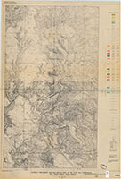
Preliminary geologic map of [NW] part of the Flint Hill quadrangle, Fall River County, South Dakota, figure 5
Links
- Plate: Plate 1 (pdf)
- Superseding Publications:
- Download citation as: RIS | Dublin Core
Abstract
No abstract available.
Study Area
| Publication type | Report |
|---|---|
| Publication Subtype | USGS Numbered Series |
| Title | Preliminary geologic map of [NW] part of the Flint Hill quadrangle, Fall River County, South Dakota, figure 5 |
| Series title | Open-File Report |
| Series number | 55-9 |
| DOI | 10.3133/ofr559 |
| Year Published | 1955 |
| Language | English |
| Publisher | U.S. Geological Survey |
| Publisher location | Reston, VA |
| Description | Plate: 35.74 x 52.53 inches |
| Country | United States |
| State | South Dakota |
| County | Fall River county |
| Other Geospatial | Flint Hill Quadrangle |

