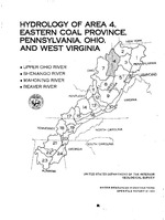
Area 4 (one of the 24 hydrologic areas defining the Eastern Coal Province) is located at the northern end of the Eastern Coal Province in eastern Ohio, northern West Virginia, and western Pennsylvania. It is part of the upper Ohio River basin, which includes the Beaver, Mahoning, and Shenango Rivers. The area is underlain by rocks of the Pottsville, Allegheny, Conemaugh, Monongahela Groups (or Formations) and Dunkard Group. Area 4 has a temperate climate with an annual average rainfall of 38 to 42 inches, most of its area is covered by forest. The soils have a high erosion potential where the vegetation cover is removed. In response to Public Law 95-87, 132 sites were added to the existing surface-water data-collection network in area 4. At these added sites, collected data includes discharge, water quality, sediment, and biology. The data are available from computer storage through the National Water Data Exchange (NAWDEX) or the published annual Water Resources Data reports for Ohio, Pennsylvania, and West Virginia. Hydrologic problems related to mining are: (1) Erosion and increased sedimentation, and (2) degradation of water quality. Erosion and sedimentation are associated chiefly with surface mining. Sediment yields increase drastically when vegetation is removed from the highly erosive soils. Degradation of water quality can be caused by acid-mine drainage from underground and surface mining. More than half the acid-mine drainage effluent in area 4 comes from underground mines. The rest seeps from abandoned surface mines. Usually in reclaimed surface mines the overburden is replaced in such a short time after the coal is taken out that oxidation of acid-forming minerals, commonly pyrite or marcasite, is not complete or is neutralized by the buffering action of calcareous minerals in the soils. (USGS)


