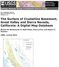
The surface of crystalline basement, Great Valley and Sierra Nevada, California: A digital map database
Links
- More information: USGS Index Page (html)
- Download citation as: RIS | Dublin Core
Abstract
Suggested Citation
Wentworth, C.M., Fisher, G., Levine, P., Jachens, R.C., 1995, The surface of crystalline basement, Great Valley and Sierra Nevada, California: A digital map database (Version 1.1; Version 1.11, Revised June 2012): U.S. Geological Survey Open-File Report 95-96, 18 p.; Figure 1 JPEG; ReadMe TXT File; Digital Database Package Zip File, https://doi.org/10.3133/ofr9596.
ISSN: 2331-1258 (online)
Study Area
| Publication type | Report |
|---|---|
| Publication Subtype | USGS Numbered Series |
| Title | The surface of crystalline basement, Great Valley and Sierra Nevada, California: A digital map database |
| Series title | Open-File Report |
| Series number | 95-96 |
| DOI | 10.3133/ofr9596 |
| Edition | Version 1.1; Version 1.11, Revised June 2012 |
| Year Published | 1995 |
| Language | English |
| Publisher | U.S. Geological Survey |
| Publisher location | Reston, VA |
| Contributing office(s) | Geology, Minerals, Energy, and Geophysics Science Center |
| Description | 18 p.; Figure 1 JPEG; ReadMe TXT File; Digital Database Package Zip File |
| Time Range Start | 1983-01-01 |
| Time Range End | 1985-12-31 |
| Country | United States |
| State | California |
| Other Geospatial | Coast Ranges;Great Valley;Sierra Nevada |
| Online Only (Y/N) | Y |
| Additional Online Files (Y/N) | Y |


