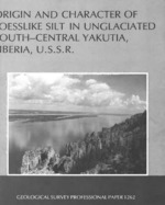
Loesslike silt mantles upland terraces and low plateaus throughout unglaciated south-central Yakutia but is thickest along the south side of the lower Aldan River valley and the east side of the Lena River valley. The silt is probably loess deposited during glacial advances by winds blowing southward from the Verkhoyansk Range and eastward across the broad vegetation-free flood plain of the braided Lena River.
The well-sorted uniform tan silt is well displayed along the Aldan and Lena Rivers; the thickest exposure measured, more than 60 m, is on the Tyungyulyu Terrace on the east side of the Lena River. On the west side of the valley, it is 10-25 m thick but thins rapidly to a featheredge west of Yakutsk. Almost all scarps along the south side of the Aldan River are capped by 10-35 m of silt.
The texture and mineral composition of the loess like silt are uniform throughout south-central Yakutia, whether it overlies limestone, poorly consolidated sandstone, alluvium, and glacial outwash. All silt samples examined contained a high percentage of quartz and feldspar. The silt stands in sheer cliffs and is massive, with little or no stratification.
The origin of the loesslike silt has been ascribed to disintegration in place of country rock by a marine, estuarine, lacustrine, fluvial, residual, or eolian source, or to a combination of these processes. The marine and estuarine hypotheses have never had strong support, but the lacustrine, fluvial, and residual hypotheses have been advanced by many Soviet workers.
The most widely accepted explanation of the origin of the upland silt is that it is a combination of lacustrine and alluvial deposits formed on great flood plains and marshy plains. This origin is unlikely, however, because there are no shorelines, wave-cut beaches, deltas, mudcracks, or ripple marks. Neither distinct stratification nor an appreciable amount of clay exists in the silt. Moreover, there is no definite upper boundary to the deposits, as would be expected of lacustrine deposits.
The loesslike silt has also been described as a residual deposit formed by the breakdown, by freezing and thawing, of the underlying rocks. The silt bears no chemical, mineralogic, or textural relation to the underlying strata, however, and it is too thick to represent only breakdown of rocks in place.
The widespread mantle of uniform loesslike silt is here considered to be windblown, derived from glacial outwash in braided streams and on broad plains, because: (1) it occurs as a surficial mantle; (2) it is lithologically independent of the underlying material; (3) it is stratified indistinctly or not at all, except in retransported material; (4) it is associated with sand dunes; (5) it contains fossils of land animals; (6) its sorting and texture are similar to that of loess and windblown dust from many places elsewhere in the world; (7) its grains are angular and relatively unweathered.


