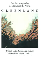
Glaciers of Greenland
Links
- More information: USGS Index Page (html)
- Larger Work: This publication is Chapter C of Satellite image atlas of glaciers of the world
- Download citation as: RIS | Dublin Core
Abstract
Suggested Citation
Weidick, A., Williams, R.S., Ferrigno, J.G., 1995, Glaciers of Greenland (Version 1.0): U.S. Geological Survey Professional Paper 1386, Report: xii, 141 p.; 1 Plate: 27.86 x 49.14 inches, https://doi.org/10.3133/pp1386C.
ISSN: 2330-7102 (online)
Study Area
| Publication type | Report |
|---|---|
| Publication Subtype | USGS Numbered Series |
| Title | Glaciers of Greenland |
| Series title | Professional Paper |
| Series number | 1386 |
| Chapter | C |
| DOI | 10.3133/pp1386C |
| Edition | Version 1.0 |
| Year Published | 1995 |
| Language | English |
| Publisher | U.S. Geological Survey |
| Contributing office(s) | Eastern Energy Resources Science Center |
| Description | Report: xii, 141 p.; 1 Plate: 27.86 x 49.14 inches |
| Larger Work Type | Report |
| Larger Work Subtype | USGS Numbered Series |
| Larger Work Title | Satellite image atlas of glaciers of the World (Professional Paper 1386) |
| Country | Greenland |


