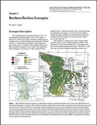
The Northern Rockies Ecoregion (Omernik, 1987; U.S. Environmental Protection Agency, 1997) covers approximately 162,746 km2 (63,200 mi2), primarily in Idaho but also including areas in western Montana and northeastern Washington (fig. 1). Canada forms the northern border of the ecoregion. To the west it is bordered by the Columbia Plateau and Blue Mountains Ecoregions, to the south by the Snake River Basin Ecoregion, and to the east by the Canadian Rockies, Middle Rockies, Northwestern Great Plains, and Northwestern Glaciated Plains Ecoregions; also to the east, the Northern Rockies Ecoregion interfingers with the Montana Valley and Foothill Prairies Ecoregion, each enclosing some isolated areas of the other (fig. 1). The ecoregion is composed of a series of high, rugged mountain ranges, mostly oriented northwest-southeast, with intermontane valleys between them (fig. 2). The entire ecoregion was glaciated during the Pleistocene (1,800,000 to 11,400 years ago), and today numerous large lakes occupy basins formed by glacial action (Omernik, 1987; Habeck and Mutch, 1973). Streams draining these mountain ranges provide a water source for many western cities and towns (fig. 3). The Continental Divide, located at the highest elevations along the northern Rocky Mountains, separates rivers that flow westward into the Columbia River watershed from those that flow eastward into the Missouri River watershed.


