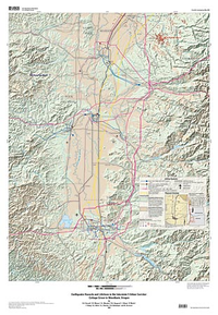
Earthquake hazards and lifelines in the Interstate 5 urban corridor: Cottage Grove to Woodburn, Oregon
Links
- More information: USGS Index Page (html)
- NGMDB Index Page: National Geologic Map Database Index Page
- Download citation as: RIS | Dublin Core
Abstract
Suggested Citation
Barnett, E.A., Weaver, C., Meagher, K., Haugerud, R., Wang, Z., Madin, I.P., Wang, Y., Wells, R., Blakely, R., Ballantyne, D.B., Darienzo, M., 2009, Earthquake hazards and lifelines in the Interstate 5 urban corridor: Cottage Grove to Woodburn, Oregon (Version 1.0): U.S. Geological Survey Scientific Investigations Map 3028, 2 Plates: 33 x 47.5 inches and 35 x 50 inches, https://doi.org/10.3133/sim3028.
ISSN: 2329-132X (online)
ISSN: 2329-1311 (print)
Study Area
| Publication type | Report |
|---|---|
| Publication Subtype | USGS Numbered Series |
| Title | Earthquake hazards and lifelines in the Interstate 5 urban corridor: Cottage Grove to Woodburn, Oregon |
| Series title | Scientific Investigations Map |
| Series number | 3028 |
| ISBN | 9781411322974 |
| DOI | 10.3133/sim3028 |
| Edition | Version 1.0 |
| Year Published | 2009 |
| Language | English |
| Publisher | U.S. Geological Survey |
| Publisher location | Reston, VA |
| Contributing office(s) | Earthquake Hazards Program, Earthquake Science Center |
| Description | 2 Plates: 33 x 47.5 inches and 35 x 50 inches |
| Country | United States |
| State | Oregon |
| City | Cottage Grove, Woodburn |
| Scale | 50000 |
| Online Only (Y/N) | N |
| Additional Online Files (Y/N) | Y |


