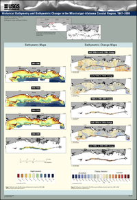
Historical bathymetry and bathymetric change in the Mississippi-Alabama coastal region, 1847-2009

Scientific Investigations Map 3154
By:  and 

Links

  • Document: Report (html)
  • Data Release: USGS data release - Historical Bathymetry in the Mississippi-Alabama Coastal Region: Bathymetric Soundings, Gridded Digital Elevation Model, and Hydrographic Sheets (Ver. 2.0)
  • Download citation as: RIS | Dublin Core

Abstract

Land loss and seafloor change around the Mississippi and Alabama (MS-AL) barrier islands are of great concern to the public and to local, state, and federal agencies. The islands provide wildlife protected areas and recreational land, and they serve as a natural first line of defense for the mainland against storm activity (index map on poster). Principal physical conditions that drive morphological seafloor and coastal change in this area include decreased sediment supply, sea-level rise, storms, and human activities (Otvos, 1970; Byrnes and others, 1991; Morton and others, 2004; Morton, 2008). Seafloor responses to the same processes can also affect the entire coastal zone. Sediment eroded from the barrier islands is entrained in the littoral system, where it is redistributed by alongshore currents. Wave and current activity is partially controlled by the profile of the seafloor, and this interdependency along with natural and anthropogenic influences has significant effects on nearshore environments. When a coastal system is altered by human activity such as dredging, as is the case of the MS-AL coastal region, the natural state and processes are altered, and alongshore sediment transport can be disrupted. As a result of deeply dredged channels, adjacent island migration is blocked, nearshore environments downdrift in the littoral system become sediment starved, and sedimentation around the channels is modified. Sediment deposition and erosion are reflected through seafloor evolution. In a rapidly changing coastal environment, understanding historically where and why changes are occurring is essential. To better assess the comprehensive dynamics of the MS-AL coastal zone, a 160-year evaluation of the bathymetry and bathymetric change of the region was conducted.
Publication type Report
Publication Subtype USGS Numbered Series
Title Historical bathymetry and bathymetric change in the Mississippi-Alabama coastal region, 1847-2009
Series title Scientific Investigations Map
Series number 3154
DOI 10.3133/sim3154
Year Published 2011
Language English
Publisher U.S. Geological Survey
Publisher location Reston, VA
Contributing office(s) St. Petersburg Coastal and Marine Science Center
Description Map: 48 inches x 70 inches
Additional Online Files (Y/N) Y
Google Analytic Metrics Metrics page
Additional publication details