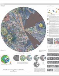
The Snegurochka Planitia region is a predominantly low-lying terrain that covers the north polar region of Venus, extending from lat 75° N. to 90° N. and from long 0° E. to 360° E. The plains associated with Snegurochka Planitia abut the highlands of Metis Mons to the south from approximately long 240° E. to 300° E. (V–6) and the highlands of Ishtar Terra to the south from approximately long 300° E. to 60° E. (Lakshmi Planum, V–7; Fortuna Tessera, V–2). The plains of Louhi Planitia also lie within the V–1 region and form the northern border with the highlands of Tethus Regio from approximately long 60° E. to 120° E. (V–3 Meskhent Tessera) and with the lowlands of both Atalanta Planitia (V–4) and the nearby deformed region containing a series of ridged belts (V–5, Pandrosos Dorsa) from approximately long 120° E. to 240° E. The plains generally lie between +500 m and -500 m of the mean planetary radius (MPR) of 6051.8 km, with the highest terrain in the region, the northernmost extent of Ishtar Terra (Itzpapalotl Tessera, lat 75° N., long ~315° E.), rising more than 6.4 km above MPR.


