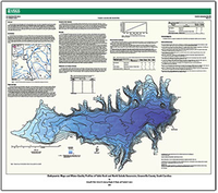
Bathymetric maps and water-quality profiles of Table Rock and North Saluda Reservoirs, Greenville County, South Carolina

Scientific Investigations Map 3289
Prepared in cooperation with Greenville Water
By: , and 

Links

Abstract

Lakes and reservoirs are the water-supply source for many communities. As such, water-resource managers that oversee these water supplies require monitoring of the quantity and quality of the resource. Monitoring information can be used to assess the basic conditions within the reservoir and to establish a reliable estimate of storage capacity. In April and May 2013, a global navigation satellite system receiver and fathometer were used to collect bathymetric data, and an autonomous underwater vehicle was used to collect water-quality and bathymetric data at Table Rock Reservoir and North Saluda Reservoir in Greenville County, South Carolina. These bathymetric data were used to create a bathymetric contour map and stage-area and stage-volume relation tables for each reservoir. Additionally, statistical summaries of the water-quality data were used to provide a general description of water-quality conditions in the reservoirs.

Study Area

Publication type Report
Publication Subtype USGS Numbered Series
Title Bathymetric maps and water-quality profiles of Table Rock and North Saluda Reservoirs, Greenville County, South Carolina
Series title Scientific Investigations Map
Series number 3289
DOI 10.3133/sim3289
Year Published 2014
Language English
Publisher U.S. Geological Survey
Publisher location Reston, VA
Contributing office(s) South Atlantic Water Science Center
Description Map: 36.00 x 32.00 inches
Country United States
State South Carolina
County Greenville County
Other Geospatial North Saluda Reservoirs, Table Rock
Datum North American Datum of 1983
Projection Lambert Conformal Conic projection
Scale 4000
Online Only (Y/N) Y
Google Analytic Metrics Metrics page
Additional publication details