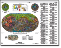
Geologic map of Mars
Links
- More information: USGS Index Page
- Document: Pamphlet (3.3 MB pdf)
- Plates:
- Additional Report Piece: Interactive map - Geologic Map of Mars, 1:20M. Tanaka et al. (2014)
- Companion File: Table D1 (133 kB pdf)
- Data Release: USGS data release - Interactive Map: USGS SIM 3292 Geologic Map of Mars
- Database: Database ZIP (790 MB)
- Metadata:
- Read Me: Read Me (6 kB txt)
- Download citation as: RIS | Dublin Core
Abstract
This global geologic map of Mars, which records the distribution of geologic units and landforms on the planet's surface through time, is based on unprecedented variety, quality, and quantity of remotely sensed data acquired since the Viking Orbiters. These data have provided morphologic, topographic, spectral, thermophysical, radar sounding, and other observations for integration, analysis, and interpretation in support of geologic mapping. In particular, the precise topographic mapping now available has enabled consistent morphologic portrayal of the surface for global mapping (whereas previously used visual-range image bases were less effective, because they combined morphologic and albedo information and, locally, atmospheric haze). Also, thermal infrared image bases used for this map tended to be less affected by atmospheric haze and thus are reliable for analysis of surface morphology and texture at even higher resolution than the topographic products.
| Publication type | Report |
|---|---|
| Publication Subtype | USGS Numbered Series |
| Title | Geologic map of Mars |
| Series title | Scientific Investigations Map |
| Series number | 3292 |
| DOI | 10.3133/sim3292 |
| Year Published | 2014 |
| Language | English |
| Publisher | U.S. Geological Survey |
| Publisher location | Reston, VA |
| Contributing office(s) | Astrogeology Science Center |
| Description | Map Sheet: 55.89 x 42.70 inches; Pamphlet: ii, 43 p.; Figure 2; Table D1; Description of Map Units with locality images; Readme; Metadata: TXT; Metadata: XML; Database |
| Other Geospatial | Mars |
| Projection | Robinson Pseudocylindrical Projection |
| Scale | 20000000 |
| Online Only (Y/N) | N |
| Additional Online Files (Y/N) | Y |


