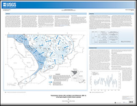
Potentiometric surface, 2012, and water-level differences, 2005-12, of the Sparta Aquifer in north-central Louisiana
Links
- More information: USGS Index Page
- Sheets:
- Download citation as: RIS | Dublin Core
Abstract
The Sparta aquifer is used in 15 parishes in north-central Louisiana, primarily for public supply and industrial purposes. Of those parishes, eight (Bienville, Claiborne, Jackson, Lincoln, Ouachita, Union, Webster, and Winn) rely on the Sparta aquifer as their principal source of groundwater. In 2010, withdrawals from the Sparta aquifer in Louisiana totaled 63.11 million gallons per day (Mgal/d), a reduction of more than 11 percent from 1995, when the highest rate of withdrawals (71.32 Mgal/d) from the Sparta aquifer were documented. The Sparta aquifer provides water for a variety of purposes which include public supply (34.61 Mgal/d), industrial (25.60 Mgal/d), rural domestic (1.50 Mgal/d), and various agricultural (1.40 Mgal/d). Of the 13 major aquifers or aquifer systems in Louisiana, the Sparta aquifer is currently (2012) the sixth most heavily pumped. The Sparta aquifer is the second most heavily pumped aquifer in Arkansas, which borders Louisiana to the north. In 2005, 170 Mgal/d were withdrawn from the Sparta aquifer in eastern and southern Arkansas; of that total, about 15.55 Mgal/d were withdrawn from the aquifer in Union County, which borders Claiborne and Union Parishes to the north. By 1997, a large cone of depression (a cone-shaped depression in the potentiometric surface caused by and centered on a pumping well or wells) in the Sparta aquifer centered over Union County had merged with the cone of depression at West Monroe. In 2004, the rate of withdrawal from the Sparta aquifer in Union County began to decline and water levels in the aquifer began to rise in nearby areas of Arkansas and Louisiana.
Study Area
| Publication type | Report |
|---|---|
| Publication Subtype | USGS Numbered Series |
| Title | Potentiometric surface, 2012, and water-level differences, 2005-12, of the Sparta Aquifer in north-central Louisiana |
| Series title | Scientific Investigations Map |
| Series number | 3313 |
| DOI | 10.3133/sim3313 |
| Year Published | 2015 |
| Language | English |
| Publisher | U.S. Geological Survey |
| Publisher location | Reston, VA |
| Contributing office(s) | Louisiana Water Science Center |
| Description | 2 Sheets: 44.00 x 34.00 inches |
| Time Range Start | 2005-01-01 |
| Time Range End | 2012-12-31 |
| Country | United States |
| State | Louisiana |
| Other Geospatial | Sparta Aquifer |
| Online Only (Y/N) | N |
| Additional Online Files (Y/N) | N |


