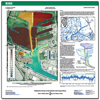
Bathymetric survey of Lake Calumet, Cook County, Illinois
Links
- More information: USGS Index Page
- Document: SIM 3330 (80 MB pdf)
- Download citation as: RIS | Dublin Core
Abstract
The U.S. Geological Survey collected bathymetric data in Lake Calumet and a portion of the Calumet River in the vicinity of Lake Calumet to produce a bathymetric map. The bathymetric survey was made over 3 days (July 26, September 11, and November 7, 2012). Lake Calumet has become a focus area for Asian carp rapid-response efforts by state and federal agencies, and very little bathymetric data existed prior to this survey. This bathymetric survey provides data for a variety of scientific and engineering studies of the area; for example, hydraulic modeling of water and sediment transport from Lake Calumet to the Calumet River.
Suggested Citation
Duncker, J.J., Johnson, K.K., Sharpe, J.B., 2015, Bathymetric survey of Lake Calumet, Cook County, Illinois: U.S. Geological Survey Scientific Investigations Map 3330, 1 sheet, https://doi.org/10.3133/sim3330.
ISSN: 2329-132X (online)
Study Area
| Publication type | Report |
|---|---|
| Publication Subtype | USGS Numbered Series |
| Title | Bathymetric survey of Lake Calumet, Cook County, Illinois |
| Series title | Scientific Investigations Map |
| Series number | 3330 |
| DOI | 10.3133/sim3330 |
| Year Published | 2015 |
| Language | English |
| Publisher | U.S. Geological Survey |
| Publisher location | Reston, VA |
| Contributing office(s) | Illinois Water Science Center |
| Description | 1 sheet |
| Country | United States |
| State | Illinois |
| County | Cook County |
| Other Geospatial | Lake Calumet |
| Online Only (Y/N) | Y |
| Additional Online Files (Y/N) | N |


