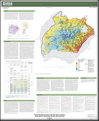
Regional potentiometric surface of the Ozark aquifer in Arkansas, Kansas, Missouri, and Oklahoma, November 2014–January 2015
Links
- Document: Report (16.4 MB pdf)
- Download citation as: RIS | Dublin Core
Abstract
The Ozark aquifer, within the Ozark Plateaus aquifer system (herein referred to as the “Ozark system”), is the primary groundwater source in the Ozark Plateaus physiographic province (herein referred to as the “Ozark Plateaus”) of Arkansas, Kansas, Missouri, and Oklahoma. Groundwater from the Ozark system has historically been an important part of the water resource base, and groundwater availability is a concern in some areas; dependency on the Ozark aquifer as a water supply has caused evolving, localized issues. The construction of a regional potentiometric-surface map of the Ozark aquifer is needed to aid assessment of current and future groundwater use and availability. The regional potentiometric-surface mapping is part of the U.S. Geological Survey (USGS) Groundwater Resources Program initiative (http://water.usgs.gov/ogw/gwrp/activities/regional.html) and the Ozark system groundwater availability project (http://ar.water.usgs.gov/ozarks), which seeks to quantify current groundwater resources, evaluate changes in these resources over time, and provide the information needed to simulate system response to future human-related and environmental stresses.
The Ozark groundwater availability project objectives include assessing (1) growing demands for groundwater and associated declines in groundwater levels as agricultural, industrial, and public supply pumping increases to address needs; (2) regional climate variability and pumping effects on groundwater and surface-water flow paths; (3) effects of a gradual shift to a greater surface-water dependence in some areas; and (4) shale-gas production requiring groundwater and surface water for hydraulic fracturing. Data compiled and used to construct the regional Ozark aquifer potentiometric surface will aid in the assessment of those objectives.
Suggested Citation
Nottmeier, A.M., 2015, Regional potentiometric surface of the Ozark aquifer in Arkansas, Kansas, Missouri, and Oklahoma, November 2014–January 2015: U.S. Geological Survey Scientific Investigations Map 3348, 1 sheet, https://dx.doi.org/10.3133/sim3348.
ISSN: 2329-132X (online)
Study Area
Table of Contents
- Introduction
- Hydrogeologic Setting
- Methods
- Potentiometric Surface
- Acknowledgments
- Selected References
| Publication type | Report |
|---|---|
| Publication Subtype | USGS Numbered Series |
| Title | Regional potentiometric surface of the Ozark aquifer in Arkansas, Kansas, Missouri, and Oklahoma, November 2014–January 2015 |
| Series title | Scientific Investigations Map |
| Series number | 3348 |
| DOI | 10.3133/sim3348 |
| Publication Date | December 21, 2015 |
| Year Published | 2015 |
| Language | English |
| Publisher | U.S. Geological Survey |
| Publisher location | Reston, VA |
| Contributing office(s) | Arkansas Water Science Center |
| Description | 1 Sheet |
| Time Range Start | 2014-11-01 |
| Country | United States |
| State | Arkansas, Kansas, Missouri, Oklahoma |
| Online Only (Y/N) | Y |
| Additional Online Files (Y/N) | N |


