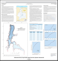
Sedimentation survey of Lago Caonillas, Utuado, Puerto Rico, September–November 2012
Links
- Sheet: Sheet 1 (1.08 MB pdf)
- Data Releases:
- USGS data release - Spatial Data for Sedimentation Survey of Lago Caonillas, Utuado, Puerto Rico, September–November 2012
- USGS data release - Spatial Data for Sedimentation Survey of Lago Caonillas, Utuado, Puerto Rico, SeptemberNovember 2012
- Download citation as: RIS | Dublin Core
Abstract
During September–November 2012, the U.S. Geological Survey, in cooperation with the Puerto Rico Aqueduct and Sewer Authority, conducted a sedimentation survey of Lago Caonillas to estimate current (2012) reservoir storage capacity and the recent (2000–2012) reservoir sedimentation rate by comparing the 2012 bathymetric survey data with the February 2000 data. The Lago Caonillas storage capacity, which was 42.27 million cubic meters in February 2000, decreased to 39.55 million cubic meters by September–November 2012. The intersurvey (2000–2012) storage capacity loss was about 6 percent, corresponding to a decrease of about 0.5 percent per year; this loss represents a reservoir sedimentation rate of about 226,670 cubic meters per year between 2000 and 2012. On a long-term basis, however, the sedimentation rate has remained nearly constant, decreasing from about 257,500 to 251,720 cubic meters per year during 1948–2000 and 1948–2012, respectively. Most of the sediment accumulation and associated storage capacity loss of Lago Caonillas has occurred within the eastern and Río Caonillas branches of the reservoir. In the vicinity of the Caonillas Dam, minor sediment deposition and scour have occurred. The Lago Caonillas drainage area sediment yield has decreased by about 2 percent since the previous survey, from 1,266 cubic meters per square kilometer per year in 2000 to 1,237 cubic meters per square kilometer per year in 2012. If the long-term sedimentation rate of 251,720 cubic meters per year remains constant, the useful life of Lago Caonillas may end in about 2169.
Suggested Citation
Soler-López, L.R., 2016, Sedimentation survey of Lago Caonillas, Utuado, Puerto Rico, September–November 2012: U.S. Geological Survey Scientific Investigations Map 3368, 1 sheet, https://dx.doi.org/10.3133/sim3368.
ISSN: 2329-132X (online)
Study Area
Table of Contents
- Introduction
- Methods of Survey and Analysis
- Storage Capacity, Sedimentation Rate, and Useful Life
- Summary and Conclusions
- Selected References
| Publication type | Report |
|---|---|
| Publication Subtype | USGS Numbered Series |
| Title | Sedimentation survey of Lago Caonillas, Utuado, Puerto Rico, September–November 2012 |
| Series title | Scientific Investigations Map |
| Series number | 3368 |
| DOI | 10.3133/sim3368 |
| Publication Date | November 09, 2016 |
| Year Published | 2016 |
| Language | English |
| Publisher | U.S. Geological Survey |
| Publisher location | Reston, VA |
| Contributing office(s) | Caribbean Water Science Center |
| Description | 29.00 x 30.83 inches |
| Country | United States |
| State | Puerto Rico |
| Online Only (Y/N) | Y |


