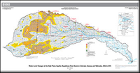
Water-level changes in the High Plains aquifer, Republican River Basin in Colorado, Kansas, and Nebraska, 2002 to 2015
Links
- Sheet: Map (6.92 MB pdf)
- Appendixes:
- Companion File: Pamphlet (5.65 MB pdf)
- Data Release: USGS Data Release - Digital map of water-level changes in the High Plains aquifer, Republican River Basin in Colorado, Kansas, and Nebraska, 2002 to 2015
- Version History: Version History (2.13 kB txt)
- Download citation as: RIS | Dublin Core
Abstract
The High Plains aquifer underlies 111.8 million acres (about 175,000 square miles) in parts of eight States—Colorado, Kansas, Nebraska, New Mexico, Oklahoma, South Dakota, Texas, and Wyoming. More than 95 percent of the water withdrawn from the High Plains aquifer is used for irrigation. Water-level declines began in parts of the High Plains aquifer soon after the beginning of substantial irrigation with groundwater in the aquifer area (about 1950). The Republican River Basin is 15.9 million acres (about 25,000 square miles) and is located in northeast Colorado, northern Kansas, and southwest Nebraska. The Republican River Basin overlies the High Plains aquifer for 87 percent of the basin area. Water-level declines had begun in parts of the High Plains aquifer within the Republican River Basin by 1964. In 2002, management practices were enacted in the Middle Republican Natural Resources District in Nebraska to comply with the Republican River Compact Final Settlement. The U.S. Geological Survey, in cooperation with the Middle Republican Natural Resources District, completed a study of water-level changes in the High Plains aquifer within the Republican River Basin from 2002 to 2015 to enable the Middle Republican Natural Resources District to assess the effect of the management practices, which were specified by the Republican River Compact Final Settlement. Water-level changes determined from this study are presented in this report.
Water-level changes from 2002 to 2015 in the High Plains aquifer within the Republican River Basin, by well, ranged from a rise of 9.4 feet to a decline of 43.2 feet. The area-weighted, average water-level change from 2002 to 2015 in this part of the aquifer was a decline of 4.5 feet.
Suggested Citation
McGuire, V.L., 2017, Water-level changes in the High Plains aquifer, Republican River Basin in Colorado, Kansas, and Nebraska, 2002 to 2015 (ver. 1.2, March 2017): U.S. Geological Survey Scientific Investigations Map 3373, 10 p., 1 sheet with appendix, https://doi.org/10.3133/sim3373.
ISSN: 2329-132X (online)
Study Area
Table of Contents
- Abstract
- Introduction
- Data and Methods
- Water-Level Changes, 2002 to 2015
- Summary
- Acknowledgments
- References Cited
- Appendix-Report Datasets
| Publication type | Report |
|---|---|
| Publication Subtype | USGS Numbered Series |
| Title | Water-level changes in the High Plains aquifer, Republican River Basin in Colorado, Kansas, and Nebraska, 2002 to 2015 |
| Series title | Scientific Investigations Map |
| Series number | 3373 |
| DOI | 10.3133/sim3373 |
| Edition | Version 1.0: Originally posted December 29, 2016; Version 1.1: February 10, 2017; Version 1.2: March 27, 2017 |
| Publication Date | December 29, 2016 |
| Year Published | 2017 |
| Language | English |
| Publisher | U.S. Geological Survey |
| Publisher location | Reston, VA |
| Contributing office(s) | Nebraska Water Science Center |
| Description | Sheet: 35.0 x 36.0 inches; Pamphlet: iv, 10 p.; Appendix Well Files; Data Release; Version History |
| Country | United States |
| State | Colorado, Kansas, Nebraska |
| Other Geospatial | High Plains Aquifer, Republican River Basin |
| Online Only (Y/N) | Y |
| Additional Online Files (Y/N) | Y |


