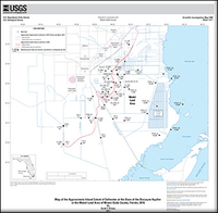
Map of the approximate inland extent of saltwater at the base of the Biscayne aquifer in the Model Land Area of Miami-Dade County, Florida, 2016
Links
- Document: Pamphlet (503 kB pdf)
- Sheet: Map (867 kB pdf)
- Data Release: USGS Data Release - Data pertaining to mapping the approximate inland extent of saltwater at the base of the Biscayne aquifer in the Model Land Area of Miami-Dade County, Florida, 2016
- Download citation as: RIS | Dublin Core
Abstract
The inland extent of saltwater at the base of the Biscayne aquifer in the Model Land Area of Miami-Dade County, Florida, was mapped in 2011. Since that time, the saltwater interface has continued to move inland. The interface is near several active well fields; therefore, an updated approximation of the inland extent of saltwater and an improved understanding of the rate of movement of the saltwater interface are necessary. A geographic information system was used to create a map using the data collected by the organizations that monitor water salinity in this area. An average rate of saltwater interface movement of 140 meters per year was estimated by dividing the distance between two monitoring wells (TPGW-7L and Sec34-MW-02-FS) by the travel time. The travel time was determined by estimating the dates of arrival of the saltwater interface at the wells and computing the difference. This estimate assumes that the interface is traveling east to west between the two monitoring wells. Although monitoring is spatially limited in this area and some of the wells are not ideally designed for salinity monitoring, the monitoring network in this area is improving in spatial distribution and most of the new wells are well designed for salinity monitoring. The approximation of the inland extent of the saltwater interface and the estimated rate of movement of the interface are dependent on existing data. Improved estimates could be obtained by installing uniformly designed monitoring wells in systematic transects extending landward of the advancing saltwater interface.
Suggested Citation
Prinos, S.T., 2017, Map of the approximate inland extent of saltwater at the base of the Biscayne aquifer in the Model Land Area of Miami-Dade County, Florida, 2016: U.S. Geological Survey Scientific Investigations Map 3380, 8-p. pamphlet, 1 sheet, https://doi.org/10.3133/sim3380.
ISSN: 2329-132X (online)
Study Area
| Publication type | Report |
|---|---|
| Publication Subtype | USGS Numbered Series |
| Title | Map of the approximate inland extent of saltwater at the base of the Biscayne aquifer in the Model Land Area of Miami-Dade County, Florida, 2016 |
| Series title | Scientific Investigations Map |
| Series number | 3380 |
| DOI | 10.3133/sim3380 |
| Publication Date | July 11, 2017 |
| Year Published | 2017 |
| Language | English |
| Publisher | U.S. Geological Survey |
| Publisher location | Reston, VA |
| Contributing office(s) | FLWSC-Ft. Lauderdale |
| Description | Pamphlet: vi, 8 p.; Sheet: 20.00 x 19.64 inches; Data Release |
| Country | United States |
| State | Florida |
| County | Miami-Dade County |
| Other Geospatial | Biscayne Aquifer, Model Land Area |
| Online Only (Y/N) | Y |
| Additional Online Files (Y/N) | Y |


