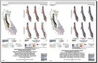
Maps showing predicted probabilities for selected dissolved oxygen and dissolved manganese threshold events in depth zones used by the domestic and public drinking water supply wells, Central Valley, California
Links
- Plates:
- Plate 1 (4.6 MB pdf) - Spatial Distribution of Predicted Probabilities for Selected Dissolved Oxygen Threshold Events
- Plate 2 (4.6 MB pdf) - Spatial Distribution of Predicted Probabilities for Selected Dissolved Manganese Threshold Events
- Data Release: Data Release - Probability distribution grids of dissolved oxygen and dissolved manganese concentrations at selected thresholds in drinking water depth zones, Central Valley, California
- Download citation as: RIS | Dublin Core
Abstract
The purpose of the prediction grids for selected redox constituents—dissolved oxygen and dissolved manganese—are intended to provide an understanding of groundwater-quality conditions at the domestic and public-supply drinking water depths. The chemical quality of groundwater and the fate of many contaminants is influenced by redox processes in all aquifers, and understanding the redox conditions horizontally and vertically is critical in evaluating groundwater quality. The redox condition of groundwater—whether oxic (oxygen present) or anoxic (oxygen absent)—strongly influences the oxidation state of a chemical in groundwater. The anoxic dissolved oxygen thresholds of <0.5 milligram per liter (mg/L), <1.0 mg/L, and <2.0 mg/L were selected to apply broadly to regional groundwater-quality investigations. Although the presence of dissolved manganese in groundwater indicates strongly reducing (anoxic) groundwater conditions, it is also considered a “nuisance” constituent in drinking water, making drinking water undesirable with respect to taste, staining, or scaling. Three dissolved manganese thresholds, <50 micrograms per liter (µg/L), <150 µg/L, and <300 µg/L, were selected to create predicted probabilities of exceedances in depth zones used by domestic and public-supply water wells. The 50 µg/L event threshold represents the secondary maximum contaminant level (SMCL) benchmark for manganese (U.S. Environmental Protection Agency, 2017; California Division of Drinking Water, 2014), whereas the 300 µg/L event threshold represents the U.S. Geological Survey (USGS) health-based screening level (HBSL) benchmark, used to put measured concentrations of drinking-water contaminants into a human-health context (Toccalino and others, 2014). The 150 µg/L event threshold represents one-half the USGS HBSL. The resultant dissolved oxygen and dissolved manganese prediction grids may be of interest to water-resource managers, water-quality researchers, and groundwater modelers concerned with the occurrence of natural and anthropogenic contaminants related to anoxic conditions. Prediction grids for selected redox constituents and thresholds were created by the USGS National Water-Quality Assessment (NAWQA) modeling and mapping team.
Suggested Citation
Rosecrans, C.Z., Nolan, B.T., and Gronberg, J.M., 2018, Maps showing predicted probabilities for selected dissolved oxygen and dissolved manganese threshold events in depth zones used by the domestic and public drinking water supply wells, Central Valley, California: U.S. Geological Survey Scientific Investigations Map 3397, 2 sheets, various scales, https://doi.org/10.3133/sim3397.
ISSN: 2329-132X (online)
Study Area
| Publication type | Report |
|---|---|
| Publication Subtype | USGS Numbered Series |
| Title | Maps showing predicted probabilities for selected dissolved oxygen and dissolved manganese threshold events in depth zones used by the domestic and public drinking water supply wells, Central Valley, California |
| Series title | Scientific Investigations Map |
| Series number | 3397 |
| DOI | 10.3133/sim3397 |
| Publication Date | January 31, 2018 |
| Year Published | 2018 |
| Language | English |
| Publisher | U.S. Geological Survey |
| Publisher location | Reston, VA |
| Contributing office(s) | California Water Science Center |
| Description | 2 Sheets: 18.99 x 24.04 inches and 18.99 x 23.75 inches; Data Release |
| Country | United States |
| State | California |
| Other Geospatial | Central Valley |
| Online Only (Y/N) | Y |

