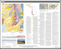
Geologic map of the Leadville North 7.5’ quadrangle, Eagle and Lake Counties, Colorado
Links
- Sheets:
- Data Release: USGS data release - Data Release for Geologic Map of the Leadville North 7.5' Quadrangle, Eagle and Lake Counties, Colorado
- Read Me: Read Me (8.00 KB txt)
- Version History: Version History (4/00 kB txt)
- Download citation as: RIS | Dublin Core
Abstract
The Leadville North 7.5’ quadrangle lies at the northern end of the Upper Arkansas Valley, where the Continental Divide at Tennessee Pass creates a low drainage divide between the Colorado and Arkansas River watersheds. In the eastern half of the quadrangle, the Paleozoic sedimentary section dips generally 20–30 degrees east. At Tennessee Pass and Missouri Hill, the core of the Sawatch anticlinorium is mapped as displaying a tight hanging-wall syncline and foot-wall anticline within the basement-cored structure. High-angle, west-dipping, Neogene normal faults cut the eastern margin of the broad, Sawatch anticlinorium. Minor displacements along high-angle, east- and west-dipping Laramide reverse faults occurred in the core of the north-plunging anticlinorium along the western and eastern flanks of Missouri Hill. Within the western half of the quadrangle, Meso- and Paleoproterozoic metamorphic and igneous rocks are uplifted along the generally east-dipping, high-angle Sawatch fault system and are overlain by at least three generations of glacial deposits in the western part of the quadrangle. 10Be and 26Al cosmogenic nuclide ages of the youngest glacial deposits indicate a last glacial maximum age of about 21–22 kilo-annum and complete deglaciation by about 14 kilo-annum, supported by chronologic studies in adjacent drainages. No late Pleistocene tectonic activity is apparent within the quadrangle.
Suggested Citation
Ruleman, C.A., Brandt, T.R., Caffee, M.W., and Goehring, B.M., 2018, Geologic map of the Leadville North 7.5’ quadrangle, Eagle and Lake Counties, Colorado: U.S. Geological Survey Scientific Investigations Map 3400, 1:24,000, https://doi.org/10.3133/sim3400.
ISSN: 2329-132X (online)
Study Area
| Publication type | Report |
|---|---|
| Publication Subtype | USGS Numbered Series |
| Title | Geologic map of the Leadville North 7.5’ quadrangle, Eagle and Lake Counties, Colorado |
| Series title | Scientific Investigations Map |
| Series number | 3400 |
| DOI | 10.3133/sim3400 |
| Publication Date | April 24, 2018 |
| Year Published | 2018 |
| Language | English |
| Publisher | U.S. Geological Survey |
| Publisher location | Reston, VA |
| Contributing office(s) | Geosciences and Environmental Change Science Center |
| Description | Map: 50.00 x 39.94 inches; Data release; Read Me |
| Country | United States |
| State | Colorado |
| County | Eagle County, Lake County |
| Online Only (Y/N) | Y |


